NSF has developed responses to each of the Thirty-Year Review’s recommendations, and these are provided in the attached document.
Search Results for:
LTER Interactive Cartographic Atlas
The LTER Interactive Cartographic Almanac is a tool to generate images of sites in the LTER Network against various backdrops. The tool was created by Jamie Hollingsworth of Bonanza Creek with support from the LNO. Images can be saved and used in presentations and publications (with attribution to Jamie). Because of the wide range of backdrops, we can now generate fresh, relevant images on demand.
International Committee Report 2012
2012 LTER Communication Committee Report
Long-Term Ecological Research Network (LTER) Springer Science+Business Media, LLC
Article by Robert B. Waide and McOwiti O. Thomas for Springer Science+Business Media, LLC
2012 Network Information System Advisory Committee Annual Report
2012 LTER Network Office report to the SC
This report summarizes activities and accomplishments of the LTER
Network Office (LNO) during the period May 1, 2011-April 30, 2012
LTER Interactive Cartographic Almanac Reference Guide
Welcome to the LTER interactive cartographic almanac. This document provides simple instructions on how to use the almanac and brief descriptions of the data layers for the National Map (48 contiguous states) and the World Map (North America with insets for Moorea and Antarctica LTER sites). National Atlas (.pdf, 65 MB) World Atlas (.pdf, 165… Read more »
Network Atlas
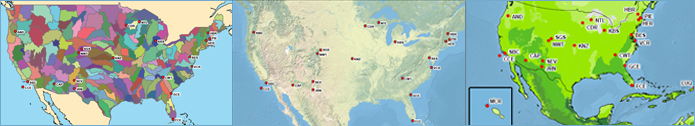
LTER Interactive Cartographic Almanac Reference Guide
The LTER Interactive Cartographic Almanac is a tool to generate
images of sites in the LTER Network against various backdrops. The tool
was created by Jamie Hollingsworth of Bonanza Creek with support from
the LNO.
LTER DataBits Spring 2012
Top Stories
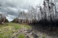
Shaped by fire: the Bonanza Creek LTER

Renewed funding for the LNO prioritizes synthesis, broadening participation, and mentorship
It begins with quality data: non-LTER student uses SBC LTER data to learn R, presents work at ESA
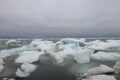
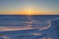
Science at the Top of the World, or, 48 Hours at Beaufort Lagoon Ecosystems LTER
Announcing the LTER Photo Contest, 2024
Engagement Practice Briefs
Crossing boundaries: two new synthesis working groups funded at the LTER

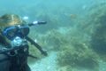
The stunning ecosystems at the SBC LTER

Coastal Connections: Living Life at Two Extremes
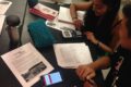
Helping students hear the stories that data tell