| Title | A developing method for directional virtual fencing (DVF trademark) and real-time range management using remote sensing, GIS and GPS |
|---|---|
| Authors: | Rango, A.;Anderson, D.M.;Hale, C.;Havstad, K.M. |
| Publication Type | Conference Proceedings |
| Year of Publication: | 2003 |
| Pagination: | Paper No. TS-11.4 |
| Publisher City: | Honolulu, HI |
| Accession Number: | JRN1954 |
Top Stories

Site Exchanges 2026

A Lesson On Why You Never Leave Your Camera Behind
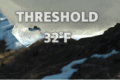
Threshold 32F exhibit offers multiple perceptions of change

The functional groups of prairie strip people

Trout Lake Station highlights 100 years of research impact

LTER Photo Contest 2025

A Day in the Life: Behind the Scenes on Sapelo Island

Fall 2025 Young Voices of Science Program

When Shade Isn’t Enough: Climate Change in the Forest Understory

What is seagrass restoration worth on the blue carbon market?