The MALs project and the workshop were motivated by the dramatic and rapid changes being observed across the LTER network and the need to understand these changes in the context of a “couple social-ecological systems” (SES) framework. The current state of SES science suggests there is a critical need for more robust interdisciplinary approaches to investigating human-environment interactions. Following from these needs, the MALs group hypothesized that the integration of spatial analysis (maps) and local knowledge provides an enhanced approach for 1) understanding change, 2) accounting for its complexity, 3) and achieving salience in research.
Top Stories

Natural Areas Conference Call for Proposals

Request for Synthesis Proposals 2026
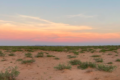
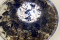
Hunting for Biocrusts: The living skin of the earth
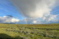
Our second summer, we were not evacuated!

2026 Synthesis Skills Course Opens

Site Exchanges 2026

Permafrost and Passion: How Two Summers in the Arctic Reignited My Love for Teaching
Bringing seeds of wonder and curiosity from the Arctic Circle to a Minnesota Classroom
LTER Community Call: Site Exchanges
The Forest Data Jam theme is "water and climate"