Goals: The goal of this project is to build on the previously funded work of Kyle Cavanaugh to complete the atmospheric corrections to the LTER Landsat catalog. Atmospheric corrections are required before any higher level data products (e.g. maps of land cover change, biomass, NDVI) can be created. The corrected scenes can then be used by LTER researchers to work on a consistent approach to further analysis of change detection, land cover classifications, and biomass calculations across LTER sites. This was the highest priority identified by the LTER Spatial Data and Analysis Ad-Hoc Committee at the 2012 All Scientist Meeting.
Top Stories

Natural Areas Conference Call for Proposals

Request for Synthesis Proposals 2026
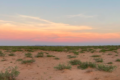
Hunting for Biocrusts: The living skin of the earth
Our second summer, we were not evacuated!

2026 Synthesis Skills Course Opens

Site Exchanges 2026

Permafrost and Passion: How Two Summers in the Arctic Reignited My Love for Teaching
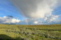
Bringing seeds of wonder and curiosity from the Arctic Circle to a Minnesota Classroom
LTER Community Call: Site Exchanges
The Forest Data Jam theme is "water and climate"