The Network
Directory
About the LTER Network
Vision/Mission/Goals
History
Mail Lists
Network Organization
Committees
Network Leadership
LTER Network Office
Photo Gallery
Video Gallery
LTER Events
2025 PI Meeting
2024 LTER Science Council Meeting
2023 Science Council
2022 Science Council Meeting
2021 Science Council Meeting
Lightning Talk Schedule
2022 All Scientists’ Meeting
2018 All Scientists’ Meeting
2021-2022 Webinar Series
LTER Code of Conduct
Resources
LTER Document Archive
Information Management Resources
Broadening Participation Resources
Education Resources
Remote Teaching Resources
Educator Recruitment
Communication Resources
Graphic Resources
Site Image Galleries
Communications Planning
Role of the LTER Network Office
Sites
Site Profiles
Site Briefs (2019)
LTER Road Trip
Site Characteristics
Site Contacts
Research
How We Work
LTER Data Resources
Key Findings
Core Themes
Synthesis
Request for Synthesis Proposals 2025
Request for Proposals 2024
Request for Proposals 2022
LTER Synthesis Working Groups
Synthesis Skills for Early Career Researchers
Working Group Archive
Synthesis Resources
Guidance for Working Group PI’s
Education
Graduate Education
Graduate Writing Fellows
Short Stories About Long-Term Research Blog
Undergraduate Research Opportunities
K-12 Education
Schoolyard Book Series
LTER DataNuggets
Data Jams
Results
LTER Data
Publications
2019 Network Self Study
Journal Articles
Reports
Books
Annual Reports
Resource Managers
LTER in the News
International
Get Involved
New to the Network
LTER Network News
Social Media
Engaging Communities
Science Engagement Project
LTER Arts & Sciences
For Teachers
Related Research Networks
Employment
Search for:
Search
LTER Research Products – Map
Search
1
2
3
4
→
1936.
“
Jornada Experimental Range, Dona Ana County, New Mexico
”
publication file
.
1957.
“
Jornada Experimental Range, Dona Ana County, New Mexico
”
publication file
.
Seager, W. R.;Hawley, J. W.;Kottlowski, F. E.;Kelley, S. A.
1987.
“
Geology of east half of Las Cruces and northeast of El Paso 1º x 2º sheets
”
Valentine, Theresa J.
2011.
“
H.J. Andrews Experimental Forest [Map]
”
Burton, W. C. ;Walsh, G. J. ;Armstrong, T. R.
2000.
“
Bedrock geology map of the Hubbard Brook Experimental Forest, Grafton County, New Hampshire
”
Barton, C. C. ;Camerlo, R. H. ;Bailey, S. W.
1997.
“
Bedrock Geologic Map of Hubbard Brook Experimental Forest and maps of fractures and geology in roadcuts along Interstate-93, Grafton County, New Hampshire
”
Vansant, H. / Associate Engineer ;Williams, R.C. / Major, Corps of Engineers
1926.
“
Mississippi River, Minneapolis to Lake Pepin, Locks and Dams, Survey of St. Croix River in 9 sheets: Sheet No. 5
”
Vansant, H. / Associate Engineer ;Williams, R.C. / Major, Corps of Engineers
1926.
“
Mississippi River, Minneapolis to Lake Pepin, Locks and Dams, Survey of St. Croix River in 9 sheets: Sheet No. 6
”
Vansant, H. / Associate Engineer ;Williams, R. C. / Major, Corps of Engineer
1926.
“
Mississippi River, Minneapolis to Lake Pepin, Locks and Dams, Survey of St. Croix River in 9 sheets: Sheet No. 7
”
Vansant, H. / Associate Engineer ;Williams, R.C. / Major, Corps of Engineers
1926.
“
Mississippi River, Minneapolis to Lake Pepin, Locks and Dams, Survey of St. Croix River in 9 sheets: Sheet No. 8
”
Vansant, H. / Associate Engineer ;Williams, R.C. / Major, Corps of Engineer
1926.
“
Mississippi River, Minneapolis to Lake Pepin, Locks and Dams, Survey of St. Croix River in 9 sheets: Sheet No. 9
”
United States Department of Agriculture ;Soil Conservation Service
1974.
“
Topography of Carpinteria Slough (El Estero Estuary). In cooperation with Santa Barbara County Food Control and Water Conservation District
”
United States Coast Survey
1869.
“
Register No. 1127. Map of a part of the coast of California (Santa Barbara Channel) from Sand Point to Point Gorda; and Register No. 1128 from Santa Barbara to Sand Point
”
United States Coast and Geodetic Survey
1933.
“
Topographic Survey No. 4854 and 4855. Seacliff to Sand Point and Sand Point to Santa Barbara
”
Survey, U.S. Geological
1978.
“
St. Croix Dalles Quadrangle-Wisconsin-Minnesota 7.5 Minute Series
”
Survey, U.S. Geological
19__.
“
Ann Lake to Wright Quadrangle-Minnesota,Minnesota–Wisconsin 7.5 Minute Series
”
Survey, U.S. Geological
1993.
“
Marine On St. Croix Quadrangle-Minnesota-Wisconsin 7.5 Minute Series
”
Survey, U.S. Geological
19__.
“
Almena to Yellow Lake Quadrangle-Wisconsin, Wisconsin-Minnesota 7.5 Minute Series
”
Soil Conservation Service ;U.S. Department of Agriculture
1981.
“
Carpinteria Vallay watershed protection project. Santa Barbara County, California. Plans for the construction of El Estero improvements
”
Santa Barbara County
1982b.
“
Ownership structure for the western half of the Carpinteria Marsh (map)
”
1
2
3
4
→
Top Stories
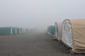
24 Hours at Toolik Field Station
LTER Network Strategic Plan 2026-2035
Site Exchanges 2026
A Lesson On Why You Never Leave Your Camera Behind
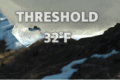
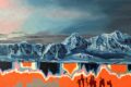
Threshold 32F exhibit offers multiple perceptions of change
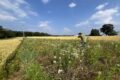
The functional groups of prairie strip people
Trout Lake Station highlights 100 years of research impact
LTER Photo Contest 2025
A Day in the Life: Behind the Scenes on Sapelo Island
Fall 2025 Young Voices of Science Program
Publication Types
Journal Article
Thesis
Book Chapter
Book
Conference Proceedings
Miscellaneous
Search for:
Search