| Title | Using remotely sensed data and GIS to map hurricane damage in tropical forests |
|---|---|
| Authors: | Lawrence, W.T. |
| Secondary Authors: | Gillespie, A. J. R. |
| Publication Type | Report |
| Year of Publication: | 1994 |
| Publisher Name: | Southern Forest Experiment Station |
| Publisher City: | New Orleans, LA |
| Accession Number: | LUQ.301 |
Top Stories

Shirah Strock

Dr. Nicholas Medina

The caddisfly stole my heart

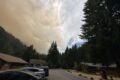
Studying post-fire Snowpack at the H.J. Andrews Experimental Forest

Summer Network-wide Postcard Exchange

What would my project be?
ILTER Webinar: Resolving and scaling litter decomposition controls from leaf to landscape
Lessons from Long-Term Data: An ARETs Experience at the H.J. Andrews LTER
Invisible Impacts Symposium
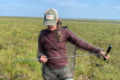
Clotheslines, Hair Ties, and Tape Measures: Low Tech Tools for the Win