Search
1996.
“An investigation of data integration and texture analysis using ERS and Landsat TM data for land cover assessment”
: viii, 169.
1991.
“Testing the utility of simple multi-date Thematic Mapper calibration algorithms for monitoring turbid inland waters”
12: 2045-2063.
1996.
“The roles of lake calcium concentration and crayfish abundance in mediating crayfish predation on snails”
: iii, 68.
1990.
“Satellite remote sensing: its evolution and synergism with GIS technology”
7 (3): 307-327.
1993.
“The "grayware" required to deal with global change issues”
59: 961-68.
1994.
“Strategies for improving the accuracy and specificity of large-area, satellite-based land cover inventories”
: 23-30.
1983.
“Use of Landsat data to predict the trophic state of Minnesota lakes”
49 (2): 219-229.
1989.
“Incorporating remote sensing and GIS technology in long-term and large scale ecological research”
1: 228-242.
1994.
“GIS applications perspective: Remote sensing and GIS as a bridge between ecologists and resource managers in the Northern Lakes States”
: 265-282.
1990.
“Long-term ecological research and the invisible present: Uncovering the processes hidden because they occur slowly or because effects lag years behind causes”
40 (7): 495-501.
1995.
“Thinking like a mountain”
Summer, 1995: 7-8.
1991.
“Automated GIS integration in landcover classification”
3: 23-32.
Top Stories

Shirah Strock

Dr. Nicholas Medina

The caddisfly stole my heart

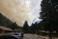
Studying post-fire Snowpack at the H.J. Andrews Experimental Forest

Summer Network-wide Postcard Exchange

What would my project be?
ILTER Webinar: Resolving and scaling litter decomposition controls from leaf to landscape
Lessons from Long-Term Data: An ARETs Experience at the H.J. Andrews LTER
Invisible Impacts Symposium
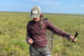
Clotheslines, Hair Ties, and Tape Measures: Low Tech Tools for the Win