Theresa Valentine and Don Henshaw discuss their approach to the marriage of tabular and spatial data at the
Andrews LTER. Barrie Collins gives his take on ArcIMS, ESRI, and his management philosophy. We are
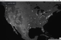
exposed to adding internet spatial visualization to environmental projects when Peter McCartney discusses
three internet map applications produced by The Center for Environmental Studies, Arizona State University.
Also in this issue a move towards maximizing the spatial aspect of the LTER Network is taken with a new
Network-wide survey.
DataBits continues as a semi-annual electronic publication of the Long Term Ecological Research Network. It is
designed to provide a timely, online resource for research information managers and to incorporate rotating coeditorship. Availability is through web browsing as well as hardcopy output. LTER mail list IMplus will receive
DataBits publication notification. Others may subscribe by sending email to majordomo@lternet.edu with two
lines “subscribe databits” and “end” as the message body. To communicate suggestions, articles, and/or
interest in co-editing, send email to databits-ed@lternet.edu.
—– Co-editors: Todd Ackerman (NWT), Chi Yang (MCM)
Table of Contents
| Feature Articles | ||
| About this Issue | 1 | |
| Integrating Spatial and Tabular Data | Theresa Valentine & Don Henshaw | 2 |
| Internet Mapping at Coweeta LTER | Barrie Collins | 5 |
| Integrating Internet Mapping into Online Data Applications | Peter McCartney | 7 |
| Maximize LTER Mapping | Todd Ackerman | 9 |
| 2003 LTER Network GIS Capabilities Survey | Ken Ramsey | 9 |
| News Bits | ||
| Journal of Environmental Informatics – CALL FOR SUBMISSIONS AND SUBSCRIPTIONS | John Porter | 12 |
| Good Reads | ||
| The Humane Interface | Theresa Valentine | 13 |
| BioScience January 2003 Special Issue | Karen Baker | 13 |
| Step Towards and Ecology of Infastructure | Karen Baker | 13 |
| Calendar | 14 |