The Spring 2012 issue of Databits is focused on highlighting geospatial activities at both individual and cross-site scales, as well as identifying resources to help manage the large collections of GIS and imagery data at LTER sites. The Information Management GIS working group provides updates on their recent workshops and their 2 cross-site projects: LTERMaps and the GeoNIS.
Feature articles include coverage of the Maps and Locals (MALS) cross-site project, the Malpai Portal in New Mexico (a prototype for the organization ad discovery of geospatial data), and a collection of selected geospatial projects from across the network. In addition, there are two related articles that provide background information on geospatial metadata standards and resources to help LTER sites document their spatial data and contribute it to the network’s data catalog. Hopefully these articles will help to inform you on the variety of projects happening in the spatial side of data management and research.
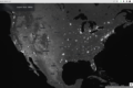
We hope you enjoy the images and internet mapping websites we found as examples of some of the latest technologies in visualization, real time data, space imagery, and other interesting cartography/art using GPS and on-line maps. The Interactive Cartographic Almanac provides a tool for LTER members to make cartographically pleasing map images for talks, publications, and websites. Jamie Hollingsworth did a nice job putting this package together for the LNO.
The IM Committee Co-Chairs have prepared a commentary about the recent discussions around the network and NSF about online availability of LTER Data. They provide some recommendations from IMExec for making data more easily discoverable, accessible, and usable.
While not geospatial centric, we have included two articles on content management systems. One is about general organization and layout of websites, and the other highlights a cross-site effort to develop a framework for LTER website development using Drupal software. This effort is helping many of the LTER sites move to a database driven development framework for their webpages, and the effort is paying off in shared expertise, tools, and connection to an Open Source community broader than LTER.
Lastly, we offer a listing of several workshops and meeting that are coming up in the next few months, including several of interest to those who would like to learn more about GIS.
Theresa Valentine (AND) theresa.valentine@oregonstate.edu and Adam Skibbe (KNZ)askibbe@ksu.edu
Spring 2012 Co-Editors
Table of Contents
| Featured Articles | ||
| Maps and Locals (MALS): A Cross-Site LTER Comparative Study of Land-Cover and Land-Use Change with Spatial Analysis and Local Ecological Knowledge | Hope C. Humphries and Patrick S. Bourgeron | 2 |
| The Malpai Portal | Ken Ramsey | 3 |
| Preparing Spatial Data and Associated Metadata for the GeoNIS | Theresa Valentine | 16 |
| Consideratiojns for making your geospatial data discoverable through the LTER metadata catalog | Inigo San Gil | 17 |
| An update on LTERMapS: Phase 2 | Adam Skibbe and Theresa Valentine | 20 |
| The GeoNIS: Adding Geospatial Capabilities to the NIS | Aaron Stephenson | 21 |
| Commentary | ||
| Are LTER data online? | Margaret O’Brien and Don Henshaw, IMC co-chairs | 22 |
| News Bits | ||
| Selected Geospatial Data Projects and Site News | 23 | |
| Good Tools And Programs | ||
| Interactive Cartographic Almanac | Jamie Hollingsworth | 25 |
| The Drupal Ecological Information Management System (DEIMS) As A Tool For Many Tasks | Eda Melendez-Colom | 25 |
| Organization and Layout for an LTER Web site using a Content Management System | Eda Melendez-Colom | 27 |
| Good Reads | ||
| Images and Internet Mapping Websites | 29 | |
| How Institutional Factors Influence the Creation of Scientific Metadata | 29 | |
| A Comparison of two information management systems | 30 | |
| Calendar | 30 |