This article originally appeared on NEON’s Observatory Blog, and was published July 6, 2022.
The NSF-funded National Ecological Observatory Network (NEON) and the Long-Term Ecological Research Network (LTER) have worked closely together since the initial design phase of the Observatory. In fact, a number of NEON sites were deliberately colocated with established LTER sites across the country. These shared spaces add value for both networks and for the research community at large.
Sharing Data, Space and Resources Across Research Networks
NEON and LTER have a lot in common—and some important differences.
The first LTER sites were founded in 1980 with funding from the National Science Foundation (NSF). Since then, the network has grown and evolved, currently supporting 28 sites in the U.S., South Pacific, and Antarctica. Over the decades, some sites have been closed and others opened, depending on the needs of the research community. Their sites include terrestrial, aquatic, urban, and marine locations.
LTER is a research network, primarily driven by “bottom-up” research by site scientists, with sites supporting a wide range of long-term data collection that address contemporary ecological questions. Cross-site synthesis is promoted by collection of data in several core areas common to all sites in the LTER network. Some sites also conduct large-scale, team-led experiments spanning the 40-year life of the program as well as shorter-term research projects led by researchers or grad students. Data from all projects are publicly available through the Environmental Data Initiative (EDI), a data repository for the environmental data community.
NEON is also funded by the NSF, but is a very different model from LTER. NEON is an Observatory, not a research network. NEON scientists and staff operate the Observatory and collect data for open use by a wide range of researchers. It is a “top-down” initiative. NEON supports 81 freshwater and terrestrial field sites organized in 20 ecoclimate Domains across the contiguous U.S., Alaska, Puerto Rico, and Hawaii. Data collection is harmonized across all sites, so the same sets of data will be collected using the same collection protocols at each terrestrial or aquatic site for the entire 30-year life of the program (with a few site-specific exceptions). All of the sites are centrally managed to ensure data quality and comparability between sites and across time. Through its Assignable Assets program, the NEON program supports outside researchers, but it does not run active research experiments. As a long-term, 30-year Observatory, it produces open-source data that is free for scientists, educators, and the public to use in a variety of ways.
Both networks provide rich and valuable data for the ecology community; the two models for long-term research complement and support each other. LTER has a 40-year history and a diverse range of ecology data, including both pure observational data and data from active experiments run by different site scientists. NEON brings data, with consistency and comparability, with hundreds of data products spanning organismal sampling and observations, soil and water chemistry and temperature, meteorological data, and remote sensing data from the Airborne Observation Platform. Researchers can also request physical samples from the NEON Biorepository or set up additional custom data collection through the NEON Assignable Assets program.
LTER data provides history, richness, and valuable experimental results; at the same time, NEON data collected at colocated sites provides additional context for LTER researchers while reducing their data collection burden. For example, a researcher studying large mammal populations (data NEON does not collect) at a colocated site could leverage all the data NEON collects, such as meteorological data, vegetation cover, microbial communities, or plant phenology. Adding these data streams to LTER research sites allows researchers to explore a variety of correlations without having to collect all that additional data themselves.
Shared NEON-LTER Field Sites
Several NEON field sites are co-located with existing or former LTER sites; here’s a closer look.
Harvard Forest (Massachusetts)
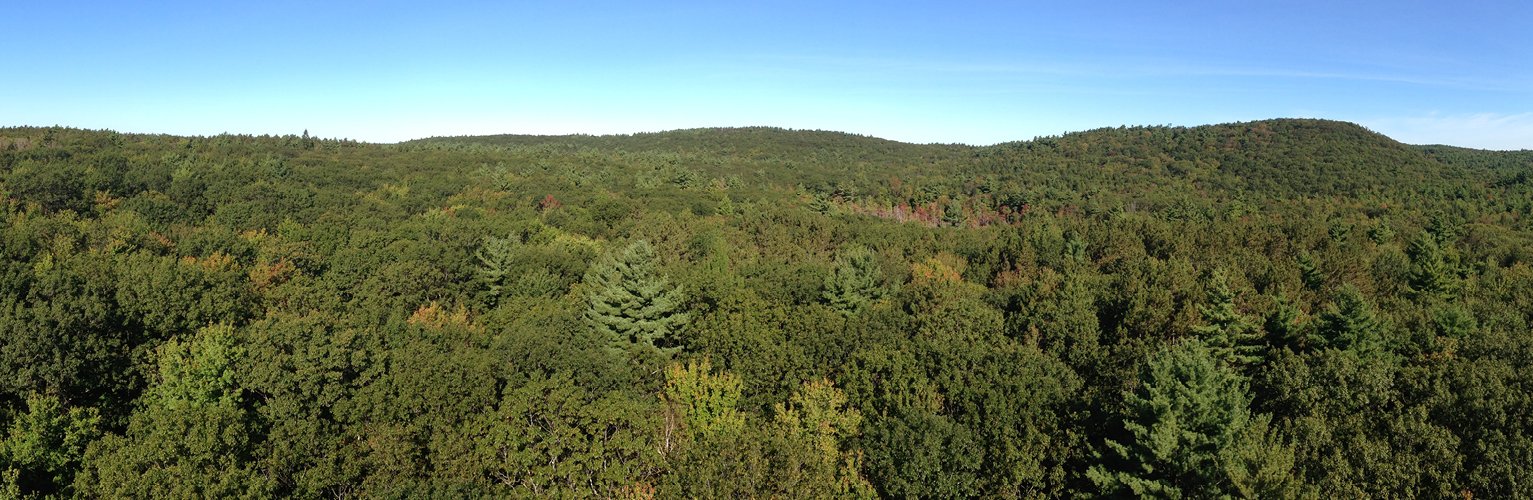
The LTER Harvard Forest site was established in 1988, but the history of ecological research here dates back much further. The field laboratory was established by the Harvard School of Forestry in 1907 on 2000 acres of donated land. The laboratory now has 4000 acres of land for forestry research and related disciplines, including soil science, wildlife biology, and botany. Current LTER research focuses on ecological processes, including forest ecosystem processes, climate change and variability, invasive insects, land-use impacts, and interacting global change drivers. The NEON terrestrial field site (HARV) covers 11,900 acres of land in Harvard Forest and the Quabbin Reservoir Watershed, with sampling plots within the LTER site. Harvard Forest is typical of northeastern woodlands, with a mix of northern hardwood and conifers.
Konza Prairie (Kansas)
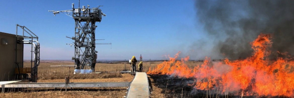
Konza Prairie was one of the first six field sites established by LTER, providing a rich history of research in the tallgrass prairie region. The site is located at the Konza Prairie Biological Station, owned by The Nature Conservancy and Kansas State University since 1971. It includes a mix of tallgrass prairie, deciduous forests, and restored prairie from former agricultural lands. This site maintains a watershed-level experimental design manipulating fire frequency and grazing pressure (bison or cattle) along with plot-level experiments investigating climate change impacts in temperate mesic grasslands. The NEON KONZ site offers a unique look at a mostly untouched tallgrass prairie ecosystem burned with a 2-year fire frequency. Just a few miles west, the NEON KONA site provides a direct contrast, with plots on managed, cultivated agricultural land. These two NEON sites provide critical data for the study of questions around native versus managed grassland ecosystems.
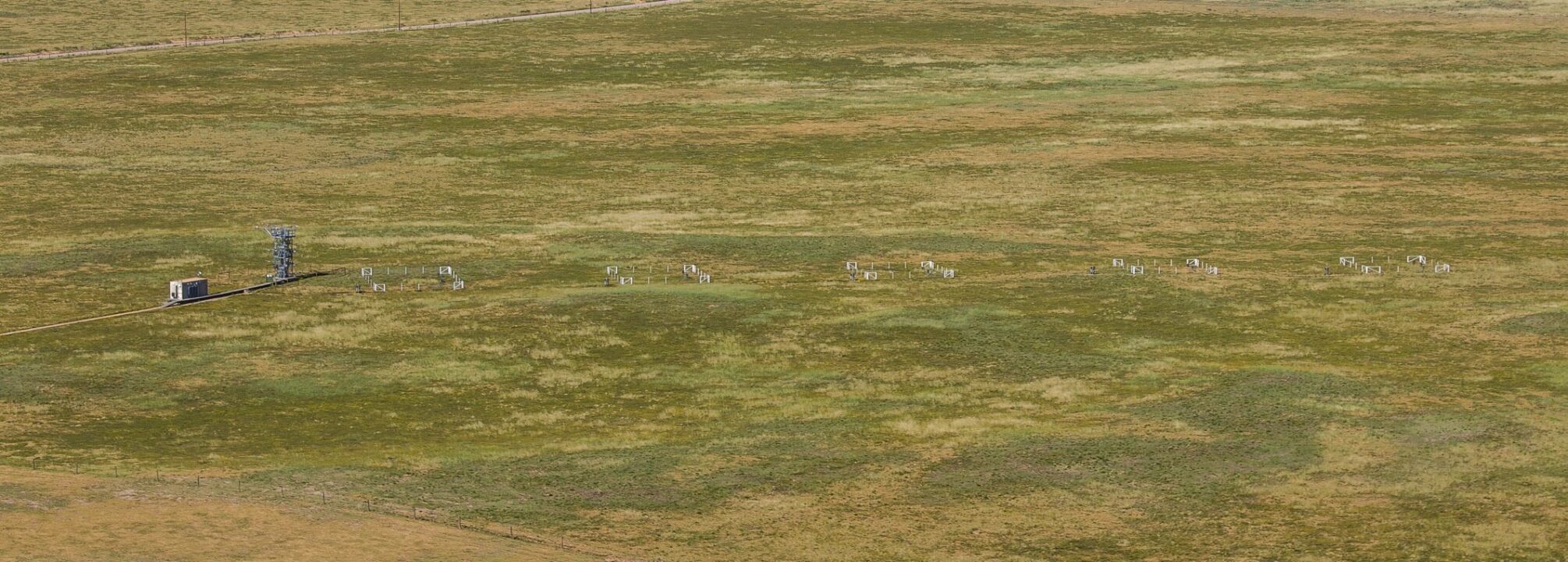
Central Plains Experimental Range/Shortgrass Steppe (Colorado)
The NEON CPER terrestrial field site, on the western boundary of the Pawnee National Grasslands, has a research history spanning back to the 1930s when it was used for grazing and soil erosion studies by the U.S. Department of Agriculture (USDA). The LTER Shortgrass Steppe site operated here from 1982 to 2014. While it is no longer an active LTER site, this historical data is still a rich trove for researchers that the NEON program can build on. It is a typical shortgrass steppe ecosystem in the Central Plains region, with moderate impact from grazing.
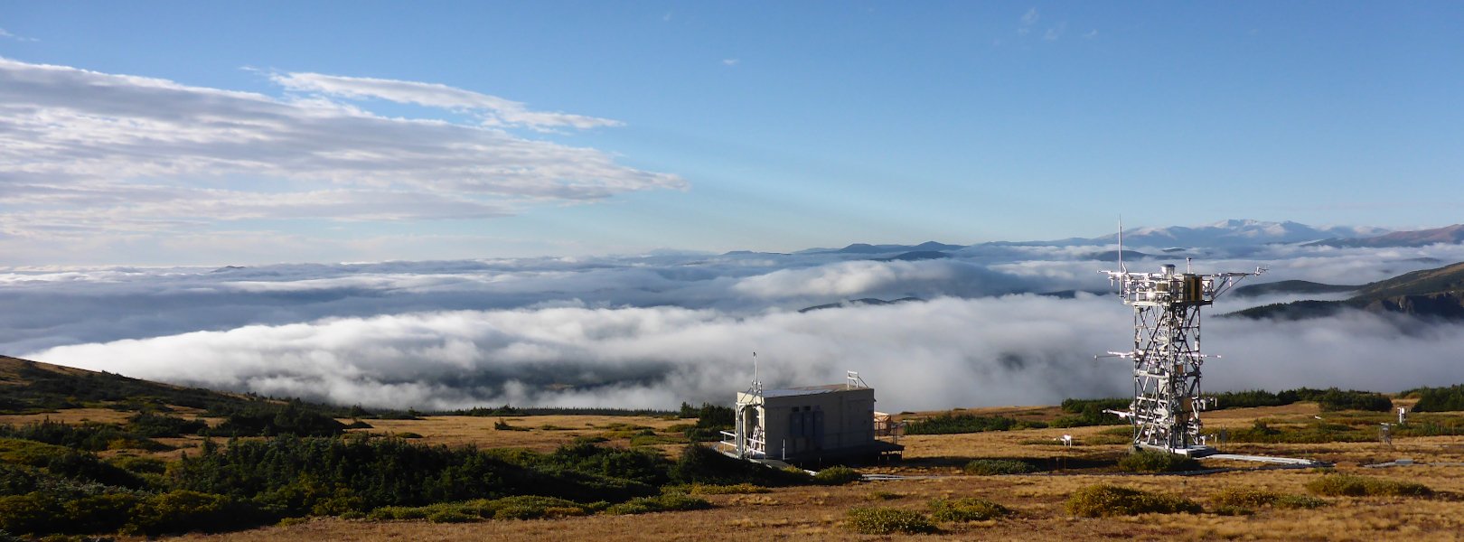
Niwot Ridge (Colorado)
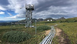
At Niwot Ridge, high in the Colorado Rockies, LTER research focuses on air, snow, water, soil, microbes, lakes, trees, flowers, and animals in high-elevation ecosystems. The Mountain Research Station at Niwot Ridge, managed by the U.S. Forest Service and the University of Colorado – Boulder Institute of Arctic and Alpine Research, was established in 1920 and hosts a number of research programs including LTER, NEON, and the Boulder Creek Critical Zone Program. Located at elevations spanning 3000-3600 m (9843-11810 ft.), Niwot Ridge features lodgepole pine and aspen forests and a diverse range of alpine animals. Data from the NEON NIWO field site provide opportunities to study the movement of energy and nutrients across the subalpine-alpine landscape, the influence of nitrogen deposition on ecosystems and hydrology, and the influence of climate on diversity and ecosystem function.
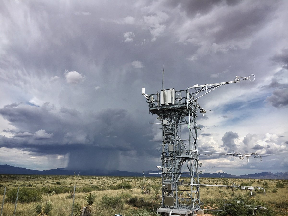
Jornada Basin (New Mexico)
Jornada Basin, at the northern edge of the Chihuahuan Desert, is representative of the arid grasslands and shrublands of this western desert that extends south into north central Mexico. Over the last 100 years, much of the region has undergone a shift from dominant grasslands to more shrub-dominated ecosystems. LTER research here focuses on vegetation change and the impacts of climate change and land use on the desert. The site is located on the Jornada Experimental Range, a long-term agricultural research site established in 1912 to study the impact of grazing on arid grasslands. Now under management of the USDA Agricultural Research Service and New Mexico State University, the field station supports research into the ecological process underlying shrub encroachment and grassland recovery in the desert southwest and global drylands. The NEON JORN site provides critical data to support these research efforts.
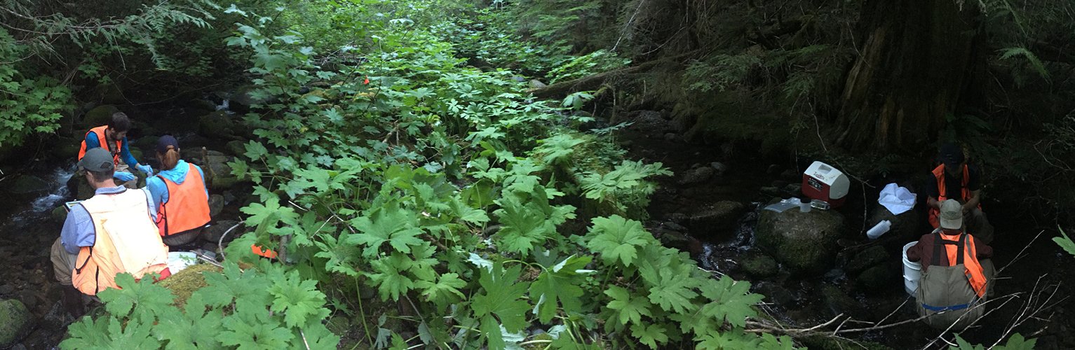
McRae Creek/HJ Andrews Experimental Forest (Oregon)
At HJ Andrews Forest, in the western Cascade Range in Oregon, LTER research priorities include successional changes in ecosystems, forest-stream interactions, microclimate effects on biodiversity distributions, population dynamics of forest stands, patterns and rates of decomposition, and disturbance regimes in forest landscapes. The Andrews Forest, established in 1948 by the U.S. Forest Service, covers 15,800 acres of rugged mountainous terrain with elevations from 410-1630 m (1350 – 5340 ft.). The region is covered in dense coniferous forests, with ecosystem characteristics varying across elevations. LTER has been active here since 1980; the site also supports a variety of other research programs, including forestry research. The NEON program maintains an aquatic field site here at McRae Creek (MCRA), a third-order stream with a 970-acre watershed.
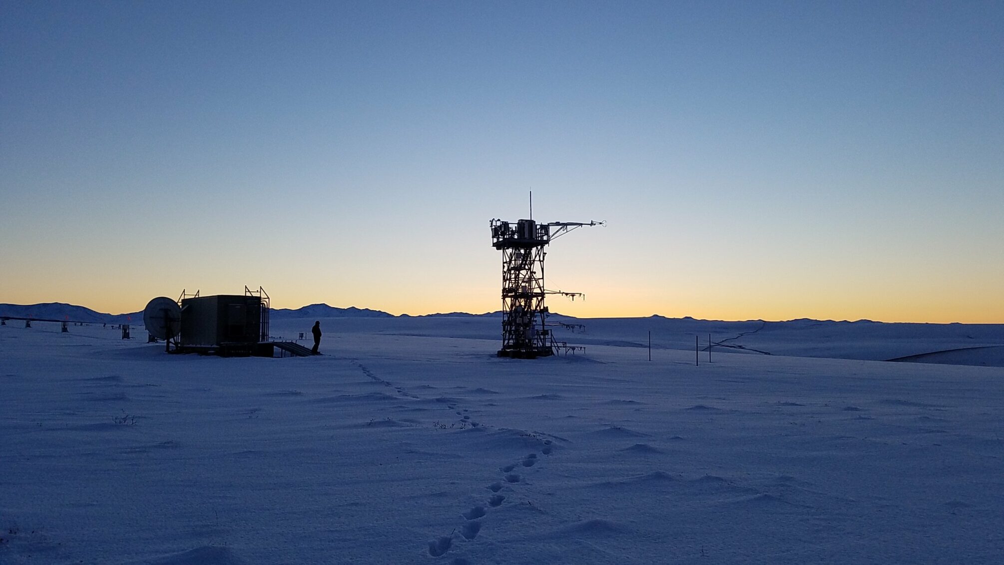
Toolik and Toolik Lake (Alaska)
The Arctic LTER research site sits in the Toolik Lake watershed in the foothills of the North Slope of Alaska. The NEON program hosts both terrestrial (TOOL) and aquatic (TOOK) field sites here. Toolik Field Station (TFS) was established in 1975 on land owned by the U.S. Bureau of Land Management; the site is protected as both a Resource Natural Area and an Area of Critical Environmental Concern (ACEC). TFS is one of the premier Arctic research stations in the world, with capacity to support more than 100 researchers during the field season. The area is extremely remote, more than 250 km (158 mi.) above the Arctic Circle in the Alaskan Tundra. The Trans-Alaska Pipeline runs nearby. The landscape features rolling glacial till plains and moraines, dominated by treeless tussock tundra and home to caribou and other iconic Arctic species. LTER research priorities include movement of nutrients and carbon between terrestrial and aquatic ecosystems, changes due to anthropogenic influences, and controls of ecological processes by nutrients and by predation.
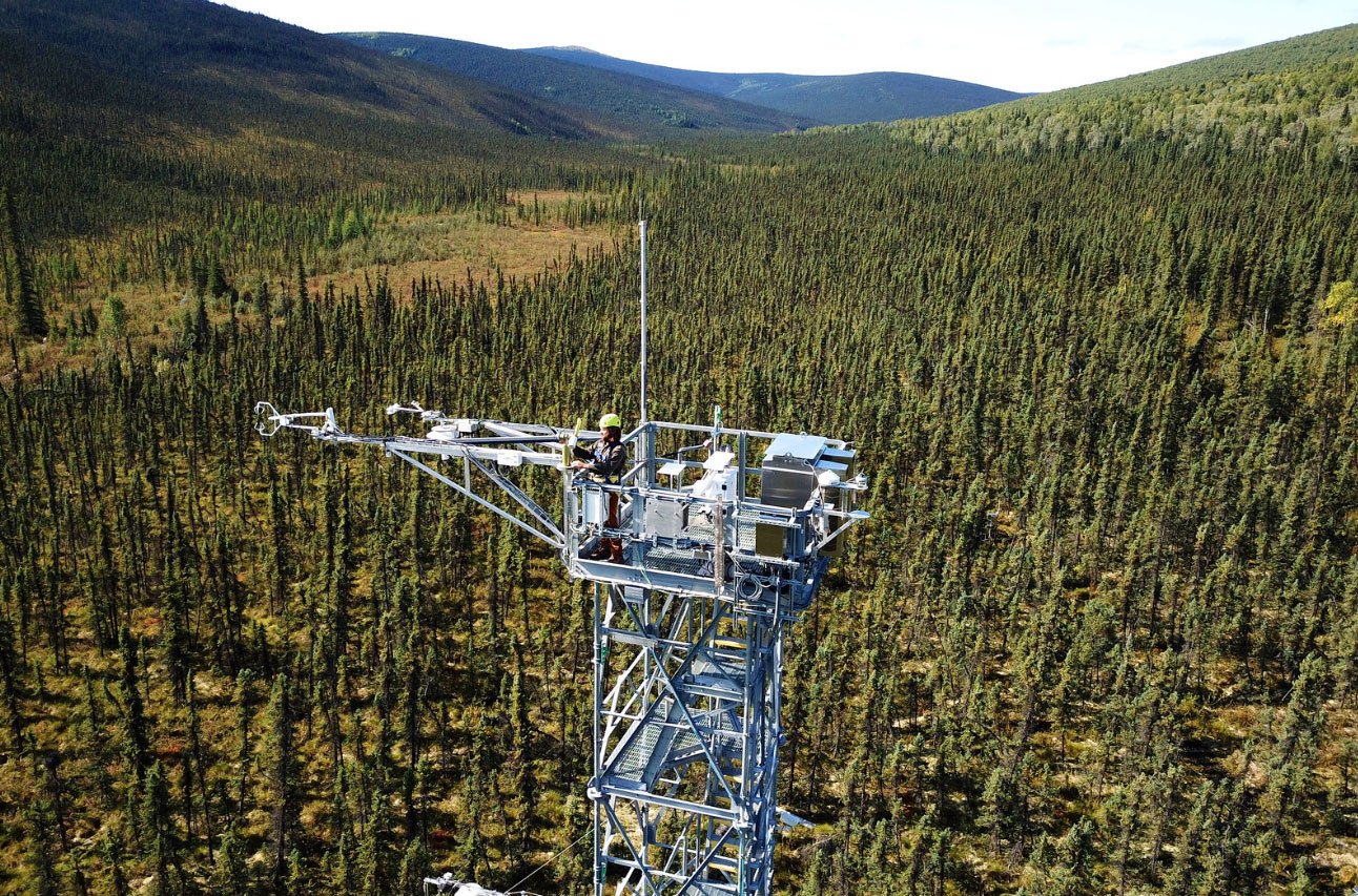
Bonanza Creek/Caribou-Poker Creeks Research Watershed (Alaska)
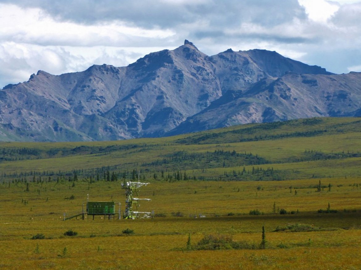
Bonanza Creek LTER is in the boreal forest and forest-tundra region of Interior Alaska. This site provides opportunities to study ecosystem processes, forest dynamics, climate change, and disturbances in the Taiga where climate is rapidly warming. The Bonanza Creek LTER was established in 1987 to study patterns and mechanisms of boreal forest succession following fluvial and fire disturbance. The program has expanded to include a wide range of terrestrial and aquatic sites located around Fairbanks, Alaska, including the Bonanza Creek Experimental Forest, the Caribou-Poker Creeks Research Watershed, and the Eight Mile Lake Watershed. The NEON program maintains a 12,300-acre terrestrial field site (BONA) and an aquatic field site (CARI) within the Caribou-Poker Creeks Research Watershed. The surrounding landscape is a mix of hardwood forest, shrubland, wetlands, and scattered permafrost.
NEON also manages a terrestrial field site (HEAL) located near the Eight Mile Lake Watershed; the landscape includes forest, tundra, and rapidly thawing permafrost soils.