Clark University’s Graduate School of Geography offers full-scholarships with stipends to doctoral students to join our vibrant and focused community of professors, researchers and students who are examining cutting-edge questions related to Geographic Information Science and Earth System Science. Click (https://www.youtube.com/watch?v=kcj81gsXeQc) to see Clark’s video concerning GIS and click (https://www.youtube.com/watch?v=2umQXWulN9g) to see Clark’s video concerning Earth System Science.
The application deadline is 31 December 2016 for the program beginning in August 2017. Apply at http://www2.clarku.edu/graduate-admissions/apply/requirements/phd-geography.cfm.
Clark University has opportunities for doctoral students to be teaching assistants and research assistants. Teaching assistants are involved in courses such as Arctic System Science, Earth System Science, Forest Ecology, Geographic Information Science, Land Change Modeling, Quantitative Methods, Remote Sensing and Wildlife Conservation. Research assistants work on projects led by professors. Below are some examples of how doctoral students are engaged in research assistantships.
Professor Ron Eastman employs research assistants as computer programmers at Clark Labs, which creates the GIS software TerrSet. TerrSet has over 100,000 users worldwide. See www.clarklabs.org.
Professor Karen Frey runs the Polar Science Research Lab, which includes Bachelors, Masters and Doctoral students with broad, interdisciplinary interests in the linkages between the land surface, ice cover, ocean, and atmosphere in polar environments. The research involves extensive fieldwork and labwork as well as remote sensing, spatial analysis and modeling. See http://wordpress.clarku.edu/kfrey/.
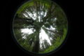
Professor Dominik Kulakowski directs the Forest Ecology Research Lab, which examines the causes and consequences of environmental change in forest ecosystems. Current and recent research focuses on how climate change, human land use and interacting disturbances, such as fires and insect outbreaks, affect mountain forests in North America and Europe. Doctoral students use a combination of field data collection, dendroecology (the study of tree rings), GIS and/or spatial modelling to address questions that advance our understanding of forest ecology and associated policy and management strategies. See http://www2.clarku.edu/faculty/facultybio.cfm?id=671.
Professor Robert Gilmore Pontius Jr has six years of funding to hire a research assistant who will use remote sensing to measure land change in an estuarine marsh, where sea level rise is particularly important. The research concerns the Plum Island Ecosystems, which is part of the Long Term Ecological Research network, funded by the National Science Foundation. See http://pie-lter.ecosystems.mbl.edu/.
Professor John Rogan invites doctoral students to work in the emerging field of Conflict Geography in the context of extractive industries. The research merges work in GIScience and Remote Sensing, with that on the Political Ecology of Natural Resource Extraction as a platform for collaboration among faculty, Bachelors, Masters and Doctoral students. See http://wordpress.clarku.edu/extractiveindustries/.
Professor Christopher Williams seeks research assistants for his Biogeosciences Research Group, which focuses on: climate impacts of forest change, biosphere-atmosphere interactions & feedbacks to the climate system, drought & disturbance impacts on carbon sequestration and water resources. The group desires applicants with experience in terrestrial ecosystem ecology, ecohydrology, biosphere-atmosphere exchange, eddy covariance, EOS remote sensing, and/or ecosystem and hydrologic process modeling. See http://wordpress.clarku.edu/cwilliams/.