Location
Site Details
Site Disposition:
The Shortgrass Steppe (SGS) Long Term Ecological Research (LTER) project is no longer active, but was funded by the National Science Foundation from 1982-2014 as one of the first sites in the US LTER Network. This collaborative, interdisciplinary research project was founded in the Natural Resource Ecology Laboratory at Colorado State University by ecosystem scientists who developed novel approaches to the study of grassland ecosystems during the International Biome Program(IBP) (1968-1974). Scientists continue to use the field research site and the rich legacy of SGS-LTER for new projects including the Summer Soil Institute, the Semi-Arid Grasslands Research Center and the USDA Long-Term AgroEcosystem Research Network.Retrospective:
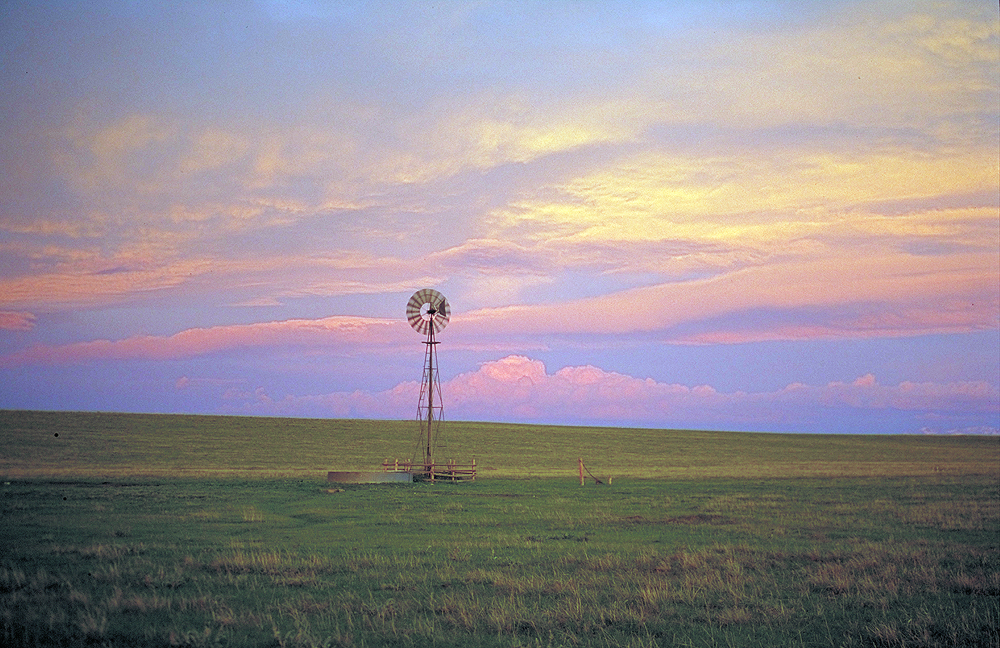
The Shortgrass Steppe (SGS) Long Term Ecological Research (LTER) project is no longer active, but was funded by the National Science Foundation from 1982-2014 as one of the first sites in the US LTER Network. This collaborative, interdisciplinary research project was founded in the Natural Resource Ecology Laboratory at Colorado State University by ecosystem scientists who developed novel approaches to the study of grassland ecosystems during the International Biome Program(IBP) (1968-1974). The SGS-LTER project was built upon the foundation of knowledge and data obtained during IBP; the primary SGS-LTER field research area was established at the old IBP grassland headquarters on the Central Plains Experimental Range (CPER), a United States Department of Agriculture’s Agricultural Research Service (ARS) site in Nunn, Colorado. The research site sits in the rain shadow of the Rocky Mountains at the western edge of the shortgrass steppe of North America. Over time, SGS-LTER scientists expanded their research studies beyond the CPER, into the Pawnee National Grassland, out across the longitudinal precipitation gradient of the Great Plains and along the latitudinal gradient from Wyoming to Mexico. They also conducted cross-site collaborative research internationally in grasslands located in South America, Asia and Africa. Our involvement in the LTER program (LTER I 1982-1986) began with spatially explicit ideas and questions about the importance of landscape structure, particularly the classic soil catena model, in the long-term development and maintenance of shortgrass steppe ecosystems. In the second phase of the project (LTER II 1987-1990) we expanded our concept of long-term processes to include the origin and persistence of spatial patterns at a range of spatial scales. This work included substantial questioning of the generality of the catena model at the CPER and in the shortgrass steppe region. Our work for LTER III (1996-2002) built upon LTER I and II and expanded the depth of our investigations into interactions between spatial and temporal patterns in ecosystem structure and function. LTER IV and V (2002-2010) extended our understanding of SGS ecosystem structure and function, by continuing a substantial suite of long-term experiments and initiating new long-term monitoring, long- and short-term experiments, and simulation analyses. Our work focused on the key biotic responses and feedbacks as influenced by humans, natural disturbances, physiography, and climate. New studies were conducted to investigate invasive species, the biology and ecological roles of prairie dogs and cactus, biogeochemical cycling under various projected precipitation regimes, the nitrogen and carbon balances of SGS ecosystems over landscape to regional scales, and the interactions between land-use and regional climate. Ecological field work, analysis, modeling, and synthesis were employed to study how climate, natural disturbance, physiography, human use, and biotic interactions influenced ecological structure and function of the shortgrass steppe, and researchers sought to identify where and when ecological relationships are most vulnerable to perturbations.Accomplishments:
Scientists at the SGS-LTER produced field methodologies, modeling tools and knowledge relevant to grassland ecologists, natural resource managers, and science educators. In summary, 60 long-term experiments were continued, 14 new long-term experiments were initiated and 10 new short-term were established. Some of the SGS-LTER work is summarized in the book ‘Ecology of the Shortgrass Steppe: A Long-Term Perspective' (Lauenroth and Burke, 2008). Over 45 years, grassland scientists produced almost 1200 journal publications, almost 400 book chapters, over 200 theses, and more than 100 core, long-term datasets with open access. Research topics have been arranged within a conceptual framework that asserts that the shortgrass steppe ecological structure and function are governed by climate, natural disturbance, physiography, human use and biotic interactions. The shortgrass steppe is unique among North American grasslands for its long evolutionary history of intense selection by both drought and herbivory, resulting in an ecosystem that is well adapted to withstand grazing by livestock, the predominant land-use in a region where precipitation is both low and highly variable. Shortgrass steppe vegetation is dominated by two species of low-growing, warm-season perennial grasses (blue grama, Bouteloua gracilis, and buffalograss, Buchloe dactyloides) that are resistant to grazing and short-term drought.Research Areas:
Community Structure

Small-scale disturbances caused by cattle fecal pats, harvester ants, small mammals and root-feeding invertebrates are the natural source of mortality for blue grama and create opportunities for the establishment and persistence of forbs and sub-shrubs. Prickly-pear cactus provides a refuge from grazing that increases local diversity. Biological activity is concentrated belowground, as reflected by the large allocation of plant production to roots and the high rates of energy flow through belowground food webs. Most biologically active elements in shortgrass steppe are protected from natural small-scale disturbances by being stored in soil organic matter. Shortgrass steppe is resistant to aboveground disturbances such as grazing, fire and invasive plants. In fact, removal of grazing results in plant communities which are more similar to disturbed areas than are heavily grazed pastures.
Large Scale Disturbance

The shortgrass steppe is, however, highly vulnerable to large-scale disturbances such as cultivation that disturb the soil, with recovery to native vegetation requiring many decades or more, as witnessed during the Dust Bowl years. It is predicted that changes in the magnitude and timing of precipitation or anthropogenic inputs of nutrients that modify the relative allocation of resources above- vs. belowground can dramatically alter ecosystem structure and function. Soil moisture, the driving abiotic determinant of productivity in shortgrass steppe, is dependent on the interactions between the biota and physiography, soil properties and the highly seasonal and pulsed nature of precipitation. Biological, geological and geochemical processes have interacted to shape the development and degradation of soils, topographic variation and the hydrological functioning of the ecosystem over tens to hundreds of thousands of years.
Changes in the magnitude and timing of precipitation that will accompany anticipated climate change will alter the spatial distribution and temporal availability of soil moisture, and therefore net primary productivity, on the landscape. Low productivity and lawn-like physiognomy of shortgrass steppe vegetation are factors that shape the structure of the habitat and refuges for animals, and have a large influence on faunal populations and biodiversity. The shortgrass steppe fauna is dominated by omnivorous, seasonally-active generalists whose biogeographic affinities are closely aligned with adjacent prairie and montane provinces. In the harsh climate characteristic of shortgrass steppe, the presence of taller, cool-season grasses and shrubs provide critical cover, resources and habitat for many species, including some of regional conservation concern. Changes in climate, CO2 or land-use that alter the distribution of these plants will have profound effects across multiple trophic levels.
Role of Fauna

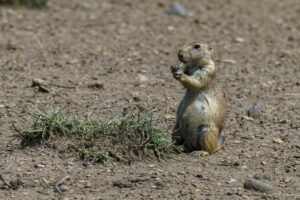
Black-tailed prairie dogs behave as ecosystem engineers in the shortgrass steppe, constructing a network of burrows which are locally abundant and serve as a persistent source of refuge belowground for other animals, and in the shortgrass steppe, prairie dogs themselves are important prey for top-level predators. Plague (Yersinia pestis), a disease caused by an invasive pathogen, has altered the metapopulation dynamics of the black-tailed prairie dog, which has had ecosystem-wide effects via a climate-mediated trophic cascade. Plague wipes out entire colonies of black-tailed prairie dogs, eliminating for years an important disturbance agent and modifier of vegetation structure and plant species composition. Outbreaks of plague are influenced by regional climatic conditions that influence the abundance of prairie dogs, flea vectors and alternative rodent hosts, and by the spatial distribution of colonies on the landscape. Because black-tailed prairie dogs compete with livestock for forage, changes in the dynamics of plague that could accompany climate and land-use change will have important consequences for the management of public grasslands.
Data Stewardship and Sharing:
In 2010, funding for SGS-LTER ecological research ceased and decommissioning work began to publish scientific findings resulting from decades of research, clean up field study installations, prepare, inventory and archive samples, and preserve and provide open access to research data. In addition to satisfying NSF requirements for submission of data to the LTER Network Information System, a collection including data, metadata and a diverse set of materials that together represent the SGS-LTER project as a whole was created. Migration of the SGS-LTER data management system was designated a pilot project for curation of research data within the Colorado State University Institutional Repository, as part of Digital Collections of Colorado.Continuing Contacts:
Photo Gallery:
Grant History:
Shortgrass Steppe LTER VI: Examining Ecosystem Persistence and Responses to Global Change
Start Date: February 1, 2011
Long Term Ecological Research Program: Shortgrass Steppe
Start Date: February 1, 1997
Long-Term Ecological Research Program – Shortgrass Steppe
Start Date: January 1, 1991


