Featured in this issue: Theresa Valentine and Don Henshaw discuss their approach to the marriage of tabular and spatial data at the Andrews LTER. Barrie Collins gives his take on ArcIMS, ESRI, and his management philosophy. We are exposed to adding internet spatial visualization to environmental projects when Peter McCartney discusses three internet map applications produced by The Center for Environmental Studies, Arizona State University. Also in this issue a move towards maximizing the spatial aspect of the LTER Network is taken with a new Network-wide survey.
Top Stories

Returning Home to California’s Kelp Forests

McMurdo and Konza featured in PBS Series

Natural Areas Conference Call for Proposals

Request for Synthesis Proposals 2026

Hunting for Biocrusts: The living skin of the earth

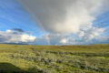
Our second summer, we were not evacuated!

2026 Synthesis Skills Course Opens

Site Exchanges 2026

Permafrost and Passion: How Two Summers in the Arctic Reignited My Love for Teaching
Bringing seeds of wonder and curiosity from the Arctic Circle to a Minnesota Classroom