Search
Top Stories
Returning Home to California’s Kelp Forests
McMurdo and Konza featured in PBS Series
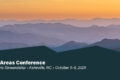
Natural Areas Conference Call for Proposals

Request for Synthesis Proposals 2026
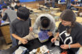
Hunting for Biocrusts: The living skin of the earth
Our second summer, we were not evacuated!

2026 Synthesis Skills Course Opens

Site Exchanges 2026
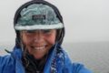
Permafrost and Passion: How Two Summers in the Arctic Reignited My Love for Teaching
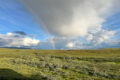
Bringing seeds of wonder and curiosity from the Arctic Circle to a Minnesota Classroom