Grad student Nick Link spent two days in Utqiaġvik, Alaska with BLE LTER experiencing research on the Arctic coast.
By: Nicholas T. Link, PhD Candidate at Northern Arizona University and Bonanza Creek LTER
Credit: Nicholas Link, CC BY-SA 4.0.
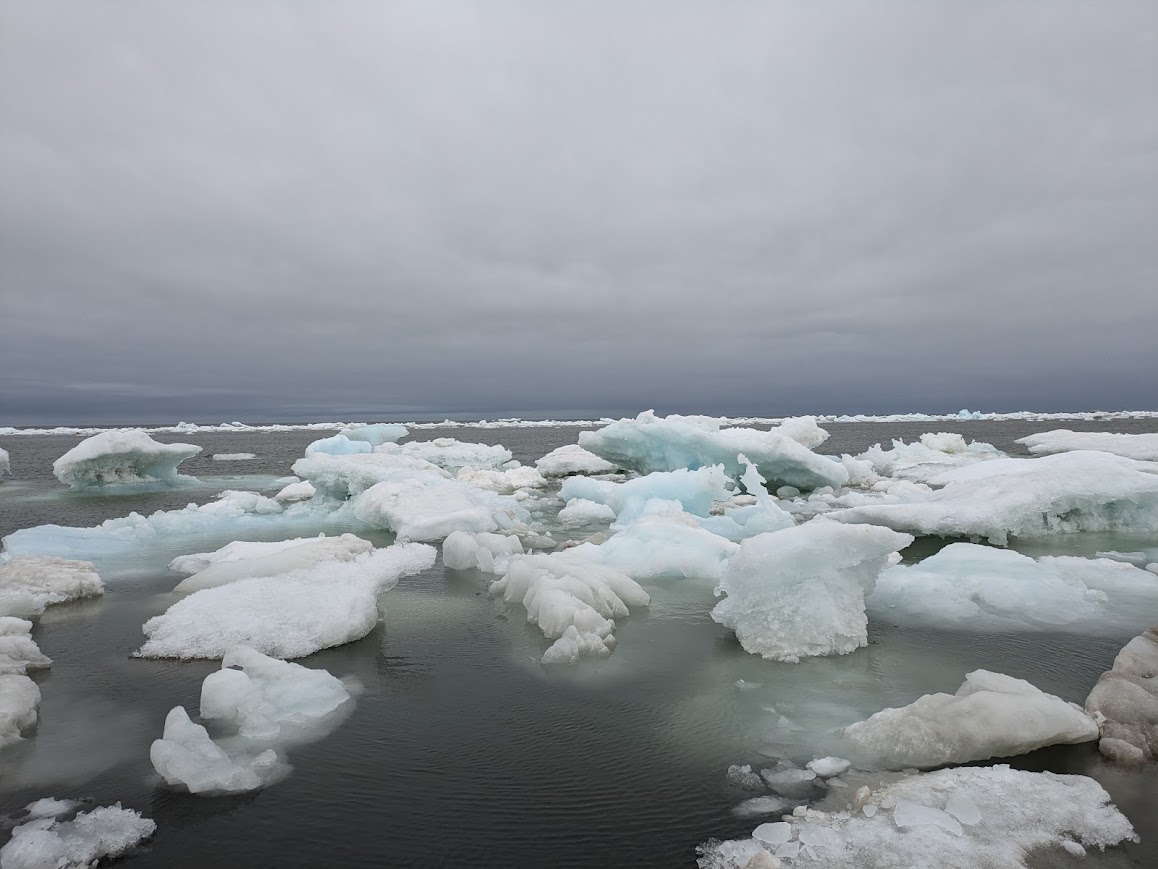
Nanuq Paŋaliktuq – the polar bear is running
The wind blowing off the Arctic Ocean is biting. When we left the Beaufort Lagoon Ecosystems (BLE) LTER lab facility in Utqiaġvik, the temperature had just cracked 32°F. It feels much colder than that now, flying along on ATVs at 45 mph through 35 knot gusts. I am not sure I understand what knots are, or how to combine them with miles-per-hour and air temperature to get windchill, but I am sure I’m cold and certainly grateful to see everyone else pull their ATVs to a stop. This patch of tundra must be the one we’re looking for.
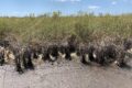
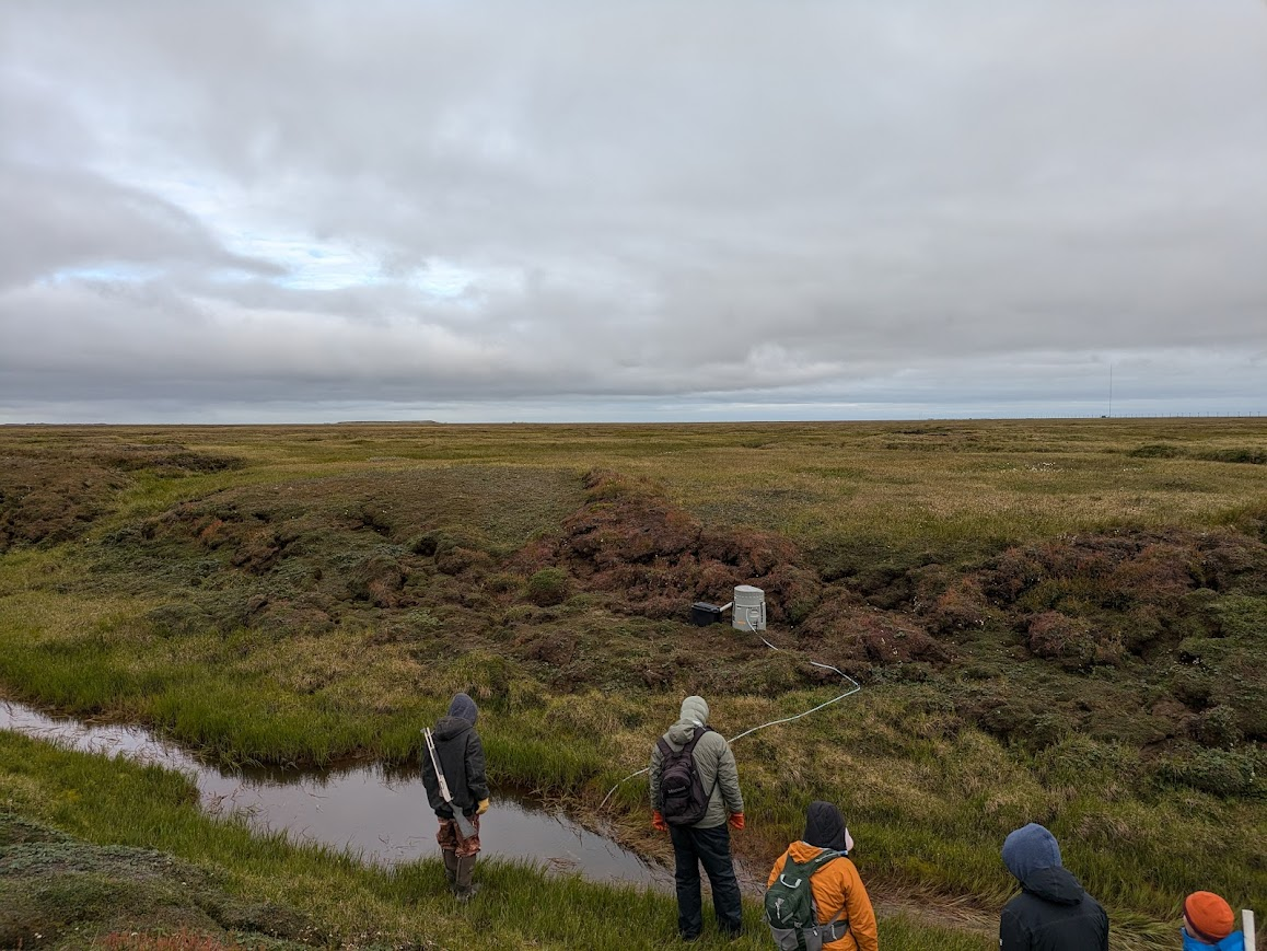
I pop the helmet off, my eyes searching unsuccessfully for anything in particular to look at. Apparently there’s an automatic data collection gizmo pulling water samples from a small stream somewhere out there. This vast treeless landscape, along with the half frozen ocean we’ve been riding past, has supported the Iñupiat—the First People of the Arctic—for 10,000 years. Their eyes are better at seeing than mine I guess.
As we trek across the tundra, Nathan McTigue, project manager for BLE, explains that water from that little streamlet, and all the organic matter dissolved in it, would have eventually made its way into Elson lagoon. Thanks to the gizmo (which I later learned is an ISCO 3700 Portable Automatic Water Sampler), that water is now trapped in a series of plastic containers and will be used to track stream inputs to the lagoon.
“The lagoons are sandwiched between well-studied ecosystems, the ocean and the land,” McTigue says, and it’s that inbetween-ness that makes them complicated to study. They’re not quite marine, not really a wetland, and certainly not terrestrial. To study them you would need multiple instruments and experts to track all the fluxes in and out from the sea, land, streams, and air. But it’s the often overlooked lagoons, McTigue tells me, that support marine life, mammals, birds, and the humans who live in the Arctic. Diving into those intricacies is the high-level mission of the BLE, but today our job is to take the water sampler apart, lug it a half-mile across the tundra to the ATVs, and haul it to the lab for processing.
Credit: Nick Link, CC BY-SA 4.0.
I stumble awkwardly back across the tundra, now weighed down by a 70-pound lead acid battery lashed to an old military-style external frame pack. Periodically I glance up from the tiny cottongrasses and cranberries to see if we’re there yet. It strikes me that without the ATVs to aim for, I would have no idea which way we’re headed. At the top of the world every direction is the same.
As we strap the water sampler and all its accompanying parts to the ATVs, the BLE crew offers to take me to Point Barrow. This juncture is where salty, nutrient-rich water coming up from the Pacific intersects with less salty, nutrient-poor water derived from the Atlantic. I’m told it creates an ecologically interesting interface between two distinct seas—the Chukchi and the Beaufort. It’s also the northernmost point in the United States, so this trip is the Arctic equivalent of a New Yorker taking out-of-towners to Times Square.
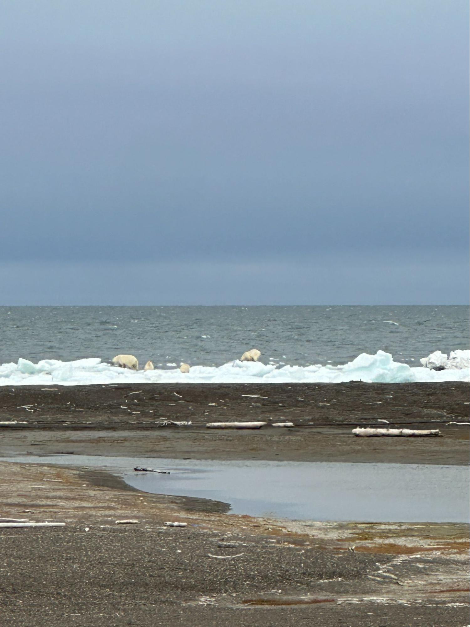
We drop the water sampler off at the lab and rip north out of town. Past the locals’ duck camp, past the end of the dirt road, and onto the beach. As the windswept point comes into view, Roxy Pikok, our bear guard from Ukpeaġvik Iñupiat Corporation and a Utqiaġvik local, hops off his ATV and saunters back towards us.
“I’ve been watching them,” he says.
“Where?” I blurt out, immediately scanning the coastline for movement.
“There, on the beach. You see them?” Roxy says, pointing now.
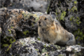
My eyes snap to follow his finger. He’s looking further down the coast than I thought one could see. But with a squint they come into focus, scampering off the gravelly beach and onto the sea ice. White fur on a backdrop of white snow disappearing into the Arctic. Nanuq. Polar bear.
Credit: Rachel Shrives, used with permission
Umiami – in the boat
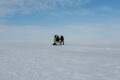
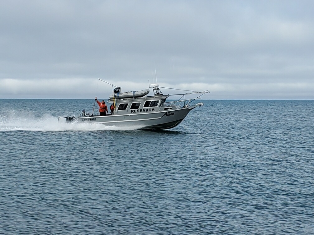
In the break room that afternoon, McTigue ran the updated sampling plan past the crew. A window of good weather was going to open between 1 and 3 AM that night.
“Let’s be de-obligated by 1800” he said.
The exact leave time was still up for discussion, but the middle of the night part was not. Remarkably, no one seemed upset by this zero-dark-thirty sampling plan. Rather, there was an air of excitement: we’re finally gonna get out on the boat! (It also doesn’t hurt that in the Land of the Midnight Sun, ‘night’ is really just a human construct).
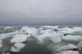
My visit to BLE was in early August, when most data are collected from boats, but this isn’t the only time of year for sampling. BLE researchers migrate north at three distinct periods to monitor lagoonal processes across seasonal cycles. Each of those seasons has its own set of challenges: freezing temperatures during Ice Cover, bumping off icebergs during Ice Break Up, and gale-force winds during Open Water. McTigue told me that to collect their routine biological and physiochemical samples as well as getting to their conductivity and temperature sensors across seasons, they have to use “many different approaches to get to the same place.” Boats, snow machines, ATVs, foot travel.
Credit: Jeff Bourke, used with permission
The mode of transportation may change with the seasons, but the central focus doesn’t. The mission of BLE—which was recently renewed for its second funding cycle by the National Science Foundation through the Office of Polar Programs—is to understand how these unique Arctic coastal ecosystems can support such a rich food web. “People might think [the Arctic] is a biological desert,” McTigue said. But in reality all kinds of life, from sperm whales to tiny plovers, come back here—back home—every year to feed and mate. Having a deep respect for nature—Qiksiksrautiqaġniq Iñuuniaġvigmun—and the underappreciated yet wildly important lagoons, is what guides their research.
Now to actually do that research requires a diverse, interdisciplinary approach. Just to describe the food web, which “seems like it should be so simple” (McTigue’s words, not mine), requires a research team of marine biologists, water chemists, geophysicists, and benthic bug specialists.
Enter the LTER.
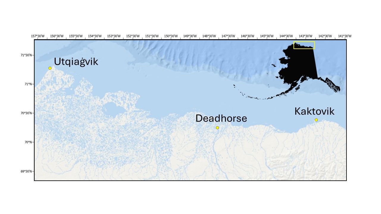
Not only impressive in its research scope, BLE also covers a tremendous spatial extent, replicating their sampling process at multiple lagoons along hundreds of miles of the Alaska Beaufort Sea coast. To get to all their sites, researchers base out of three separate nodes, each with their own flavor: Utqiaġvik is something of a metropolitan center for the region with over 4,000 mainly Iñupiat residents; Deadhorse is an oil boomtown at the end of the Dalton Highway; and Kaktovik is a tiny Iñupiaq whaling community of less than 300 people.
Credit: BLE LTER, used with permission.
It takes all those experts, spreading themselves across three seasons and hundreds of miles of Arctic coastline to understand one ‘seemingly simple’ thing: how do the lagoons support so much life?
Iñupiaqatigiigñiq – those things that make us who we are
Complicated logistics are the defining feature of BLE, with time being the central factor. As soon as I arrived in Utqiaġvik there was non-stop discussion about boat time, timing the weather, and sampling schemes given the amount of time available. McTigue joked that it takes them 11 months to plan a single month of fieldwork.
I got to chatting about this with Craig Tweedie, a professor at the University of Texas El Paso and one of the PIs helping marshall this field campaign. “It’s always a challenge,” he said. “It’s not just the weather, it’s not just the ice, it’s also people and equipment being pushed to the limit [and] working across 350 miles of coastline.”
Those challenges create an all-hands-on-deck mentality. In the Open Water season “you’ve got one boat” and in the Ice Cover season “you’ve got one hole that goes through the ice,” Tweedie told me. Aviktuaqatigiigñiq, Paammaaġiigñiq, and Paaqłakkutaiġñiq—sharing, cooperation and conflict resolution—aren’t just paid lip service here, they’re essential. Everyone, from undergraduates to full professors, live in a bunkhouse made from shipping containers. Communal data are collected by people who might not use it for their own research. Gear is prepared, organized and loaded by folks who might not be heading into the field. Even dinners and dishes are run family style. For the LTER to function, everyone has to be paddling in the same direction.
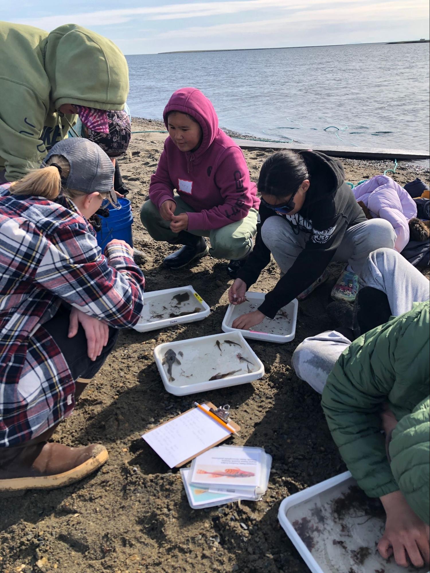
The focus on relationships at BLE extends out into the community through a variety of outreach, engagement, and educational activities. BLE works with a panel of traditional knowledge holders that advise them on relevant questions and research directions for local people. That panel also helps exchange knowledge back and forth between BLE and the community. In-person events such as the Barrow Science and Culture Fair and Kaktovik Community meetings, along with the BLE newsletter and their social media platforms, also help facilitate the transfer of information. On the education side, BLE runs the Kaktovik Oceanography Program (KOP) where K-12 students get hands-on, field research experience. The KOP focuses on issues that are relevant to the students, such as a citizen science project where students measure the erosion of their receding shoreline. The Data Nuggets program is also a well loved part of their K-12 educational program.
As valuable as those formal outreach and community engagement activities are, Tweedie told me that the relationships they’ve formed over multiple decades mean just as much. Ken Dunton, the lead PI of BLE, has been coming to the Arctic since 1977, and Tweedie since 2000. Seeing members of the community around town or at the boat ramp, “you may not even talk about science, but you’re making friends,” Tweedie said. Developing those long-term connections and having love and respect for Elders and one another—Piqpakkutiqaġniq suli Qiksiksrautiqaġniq Utuqqanaanun Allanullu—is really what matters to people.
All of the qualities that are integral to BLE—sharing, cooperation, avoiding conflict, hard work, respect for others, and respect for nature—match many of the traditional Iñupiat values or Iñupiaqatigiigñiq. It should have come as no surprise that the research team at BLE would have learned and adopted the same value structure that the Iñupiat have relied on for millennia. No one person can make it at the top of the world. It’s people who do.
Credit: Mathea Kurtz-Shaw, CC BY-SA 4.0.
* Special thanks to Professor Jerica Niayuq Leavitt, Associate Professor of Iñupiaq Studies at Iḷisaġvik College, for her help with Iñupiaq vocabulary and phrases