by Tommy Shannon, Graduate Student at FIU and the FCE LTER
Experience a day in the life of field research in the Everglades mangrove forests: full of beauty, wonder, and core research on the flow of resources through this resilient ecosystem.
Heading Out
We meet at 5:45 AM. The lab is dimly lit and quiet, except for the perpetual drones of HVAC and halogen lights. I’m still reeling from sleep. Paige, one of the other PhD candidates in my lab, comes in right after me: despite her bright orange jacket and rubber waders, she also seems to be just two steps from her bed. Rafa, the Florida Coastal Everglades LTER field manager, has been here half an hour already. He’s making coffee and preparing the equipment: barrels of bottles, coolers full of ice, a field laptop, and labeled bags. He greets us brightly, offers us coffee, and reviews the field plan with us.
Credit: Tommy Shannon, CC BY-SA 4.0.
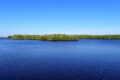
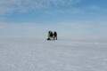
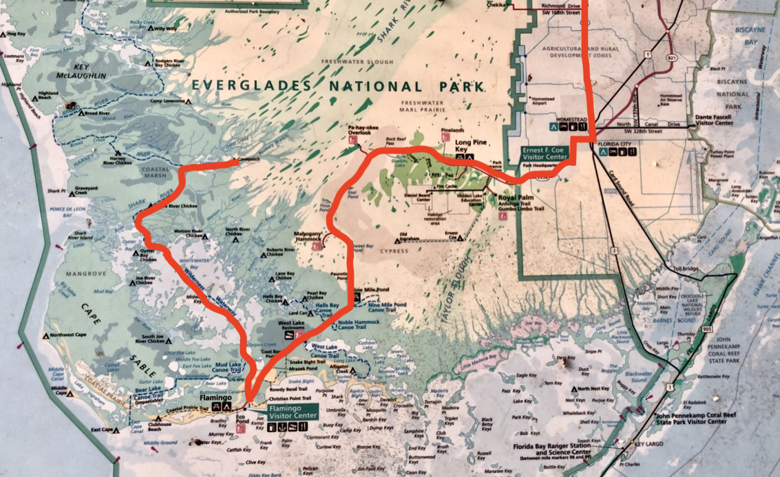
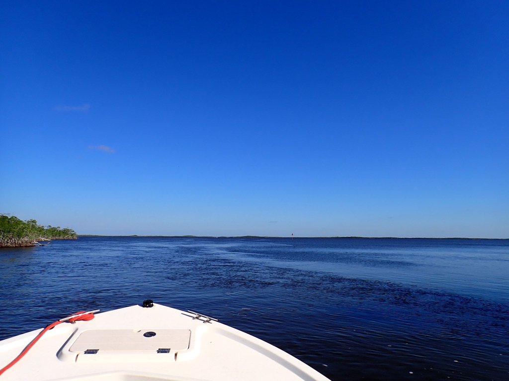
The plan is this: from Miami we will trailer a boat 75 miles south to Flamingo, the southernmost point in the mainland United States. From there we will hop in the boat and retreat back inland, winding through the mangrove canals and intercoastal bays of the Everglades for another 40 miles until we reach Shark River Slough, one of the two major drainages from the Everglades to the sea. Here the freshwater and seawater kiss and dance with the tides. Here, we will measure fluxes in carbon, nutrients, and energy between the ecosystem components: the leaves becoming mud, the rivers taking the mud out to sea, the algae converting brown to green, and the nutrients washing back to feed the trees. These processes are the dance steps of an ecosystem in careful balance; by studying them, we hope to learn how the dance will change as our climate changes its tune.
Credit: Tommy Shannon, CC BY-SA 4.0.
The Florida Coastal Everglades LTER began studying the mangrove forests, along with the marshes and bays of the coastal Everglades, in 2000. Our trip adds to a continuous data record that captures how these ecosystems change over months to decades. Big changes include shock disturbances such as hurricanes, but also slower change over extended timescales, like the influences of ecosystem restoration efforts and sea level rise. Decades of consistent sampling on trips such as ours capture the before, during, and after of these events.
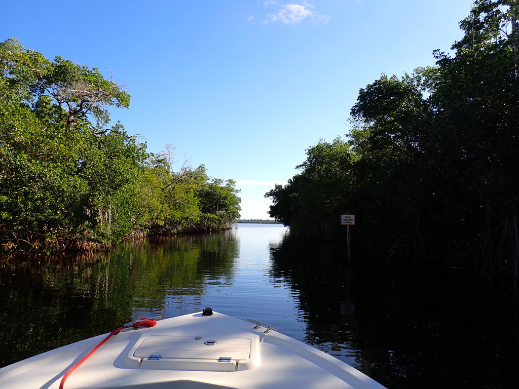
Preparations complete, we begin the day. Rafa deftly maneuvers the boat through Miami morning traffic, then through the dawn glades, then off the boat ramp and out into the mangrove channel. This first channel is really a canal, dug to provide easy access to the interior waterways. The mangroves have colonized its banks, and their thousands of strong roots form walls that stabilize the deep banks, protecting them from tidal erosion.
Getting to Know the Land
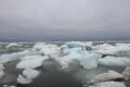
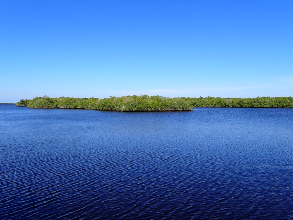
We reach the first major bay: Whitewater Bay. It’s really a huge estuarine lake, connected to the glades and the sea by hundreds of tidal creeks and rivers. FCE-LTER scientists found that 300 years ago this area looked much like the interior Everglades, full of peat soils and sawgrass marsh. A slight increase in sea level at that time caused the whole marsh to become salty, and the sawgrass died. Without their roots to stabilize the soil against flowing water, the whole marsh collapsed, drained out to sea, and became this shallow bay.
Credit: Tommy Shannon, CC BY-SA 4.0.
Rafa lets me take the wheel. He knows these waters like an old friend, and he points out the shallow spots, the rivers to take, the guiding landmarks. There is a richness of knowledge that comes from visiting the same places for so long; an intimacy with the land that cultivates deep understanding. We cruise our way inland through increasingly narrow and windy channels. Rafa points out ripples that sometimes materialize as dolphins or otters. The water is a shimmering opaque brown, full of silt brought up by the current and breeze.
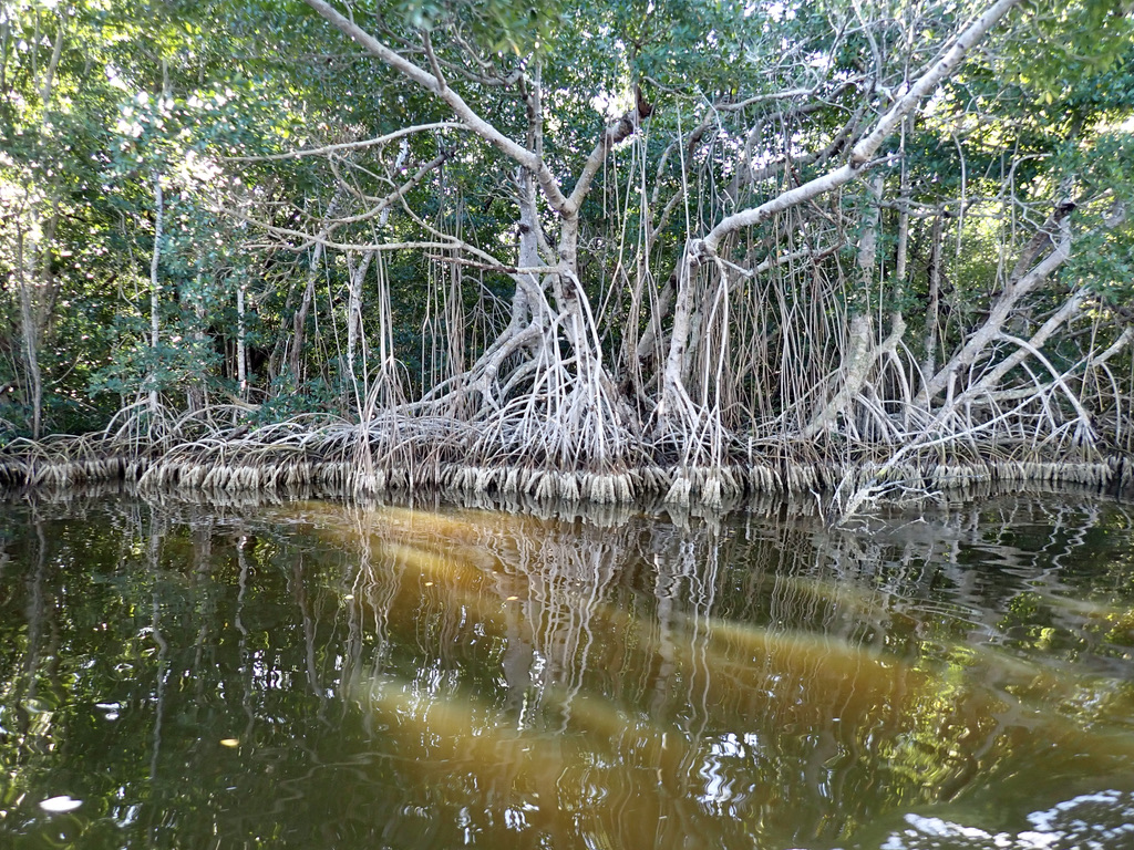
Finally we reach the first of the long-term monitoring sites. There’s a campsite nearby, where researchers can pitch a tent for the night to avoid the morning commute during long field weeks. Where we sample, though, there is no place for a tent. From the water the trees form an impenetrable wall, so closely knit we cannot see in more than a few feet, save for the small hole in the woods at the end of the boardwalk dock.
Credit: Tommy Shannon, CC BY-SA 4.0.
Credit: Tommy Shannon, CC BY-SA 4.0.
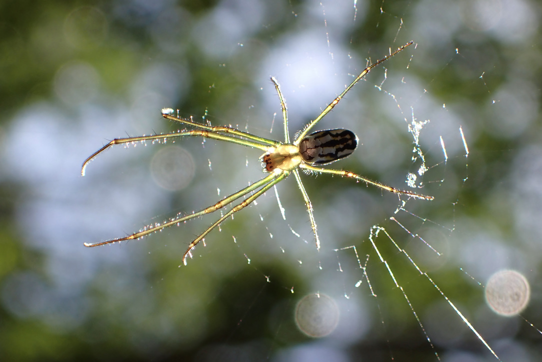
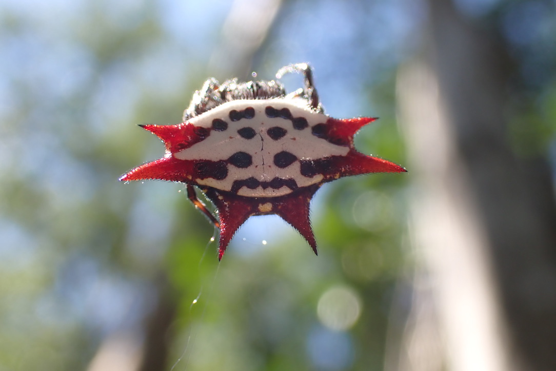
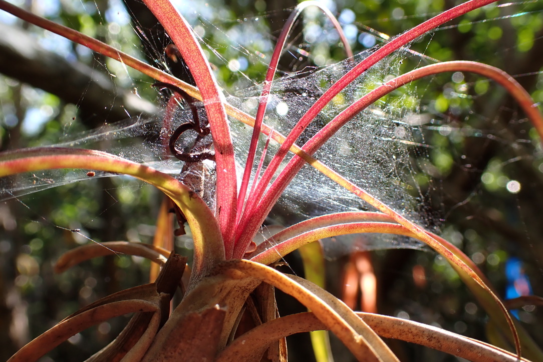
While Rafa sets up equipment on the narrow dock to take water samples of nutrients and chlorophyll, Paige and I set off into the dense mangrove forest. The dirt is firm. The dense canopy above filters out the sun, leaving us with speckled light and sunbeams. The air is thick with wood and leaves, and what little space is left has been filled in by spiders weaving webs: they blanket the trees and cross the path, catching the dew and turning it to gossamer rainbows where the morning sun comes through. The spiders themselves gleam like jewels, translucent greens and bold reds hanging in the air. It feels a shame to tear down their delicate handiwork as we pick our way down the path, though the only alternative would be a rather unpleasant face-to-face encounter.

Credit: Tommy Shannon, CC BY-SA 4.0.
Credit: Tommy Shannon, CC BY-SA 4.0.
Calling our route a path is an over-step: it is more of a “the-only-space- big-enough-to-fit-through-so-others-have-walked-here-before”. We are guided by blue and orange plastic ribbons that others have tied to the trees, marking the locations of the plots we are visiting. Spotting these guide markers through the dense foliage is a bit like an easter egg hunt, and we call out to each other as we glimpse them.
Credit: Tommy Shannon, CC BY-SA 4.0.
Collecting Data
Credit: Tommy Shannon, CC BY-SA 4.0.
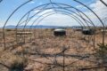
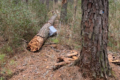
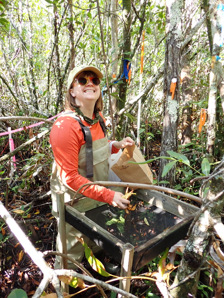
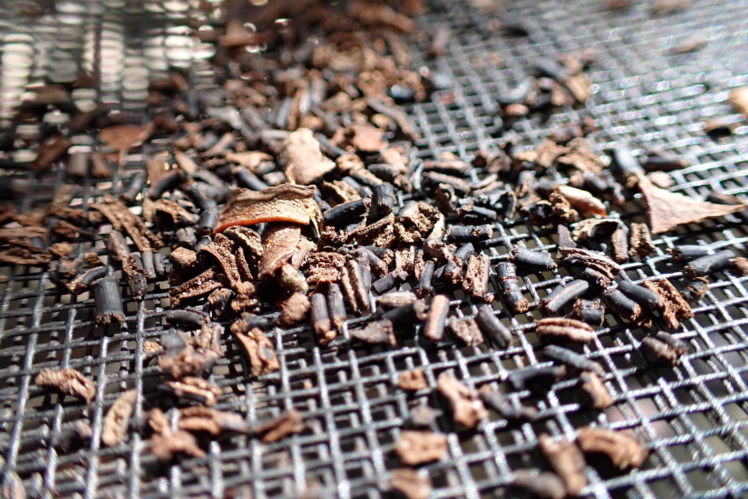
The plots themselves, when we arrive at them, are rather simple. Each plot is a square of 2×4 boards inlaid with mesh netting, and the whole sieve is planted in the air on wooden legs that have been pounded into the ground. The apparatus looks like an open-faced box with a window screen on the bottom, turned into a small table. Into the plot fall all the things that rain down from the tree canopy above. Mangrove flowers, leaves, bits of bark, and small brown things that look like tiny coffee beans. These small brown things, Rafa informs us later, are poop. Mangrove crabs climb the trees at night, and they rain down their contributions to the accreting soil.
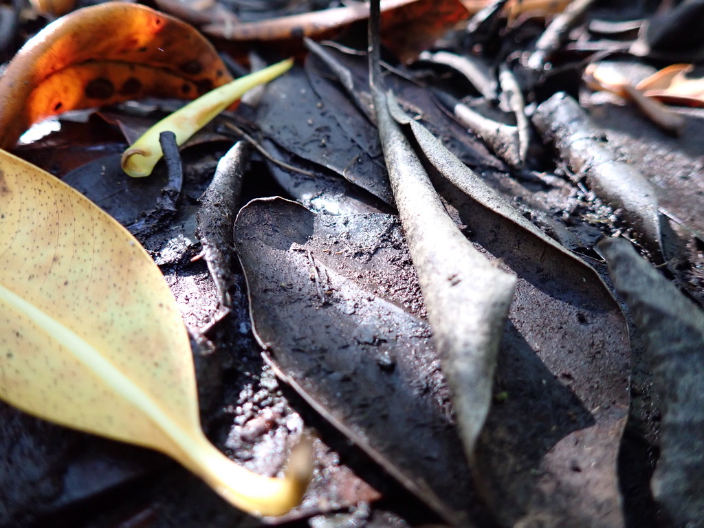
Paige and I collect the leaves that have fallen into the plots. With a standard plot area and a standard window of time between collections, we are able to measure the rate at which the mangroves’ leaf litter contributes to the ecosystem’s carbon cycle and soil accumulation. Looking around at the forest floor, I can see this happening in real time. Fallen leaves yellow, then brown, then turn mushy and become the soil. By conducting monthly assessments, we build long-term datasets that provide us with a picture of how our coastal ecosystems function over time: we can see how ecosystem rates are affected by disturbances like hurricanes, and whether these ecosystems will maintain resilience or collapse in the face of long-term stressors like sea level rise.
Credit: Tommy Shannon, CC BY-SA 4.0.
Credit: Tommy Shannon, CC BY-SA 4.0.
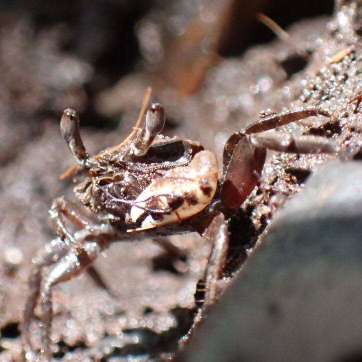
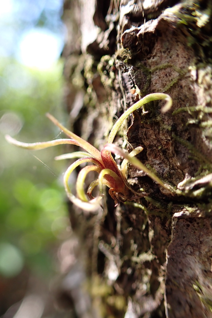
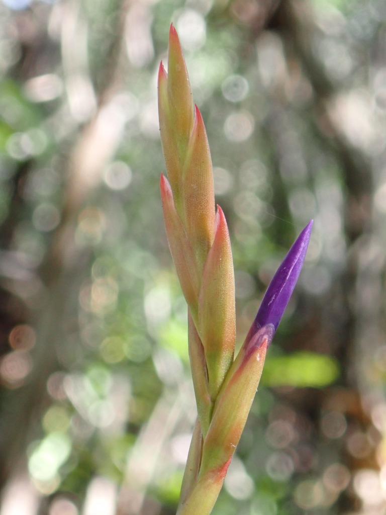
We criss-cross the forest from plot to plot, collecting leaves and admiring the small things around us. At first glance the forest appears nearly monocultural: mangroves are the only trees capable of growing in saltwater, so they dominate the landscape. Upon closer inspection though, the forest is bursting with other life sustained by the framework the mangroves provide. Many plants never touch the salted ground: vines knit the canopy; bromeliad air plants grow on the trunks of the mangroves, blooming bold reds and purples. The spiders catch tiny glittering flies, and the crabs are only one of many critters munching on the decomposing leaves and wood. Osprey and anhinga roost above. The channels are nurseries for sharks, rays, endangered sawfish, and many of the young sport fish that will support Florida’s fishing industry.
The nutrients that flow through the mangrove ecosystem support this vibrant mosaic of life. Our work to understand the changes in nutrient flows overtime underpins a broader understanding of the ecosystem as a whole, from the microbes in the soil to the predators in the water.
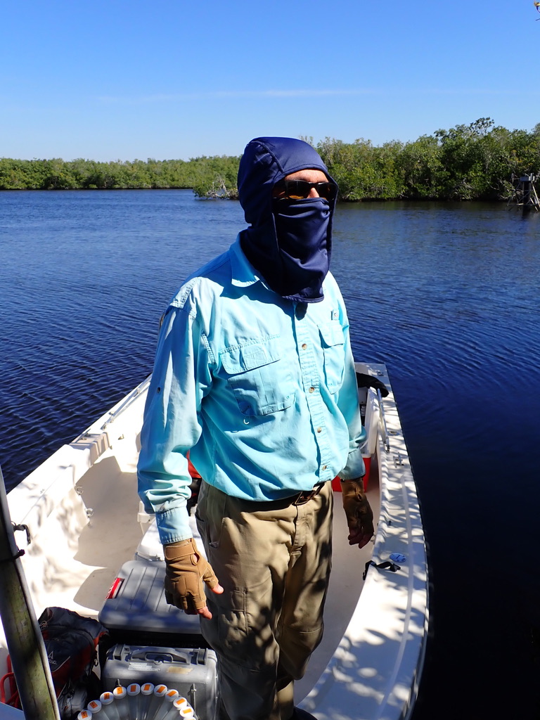
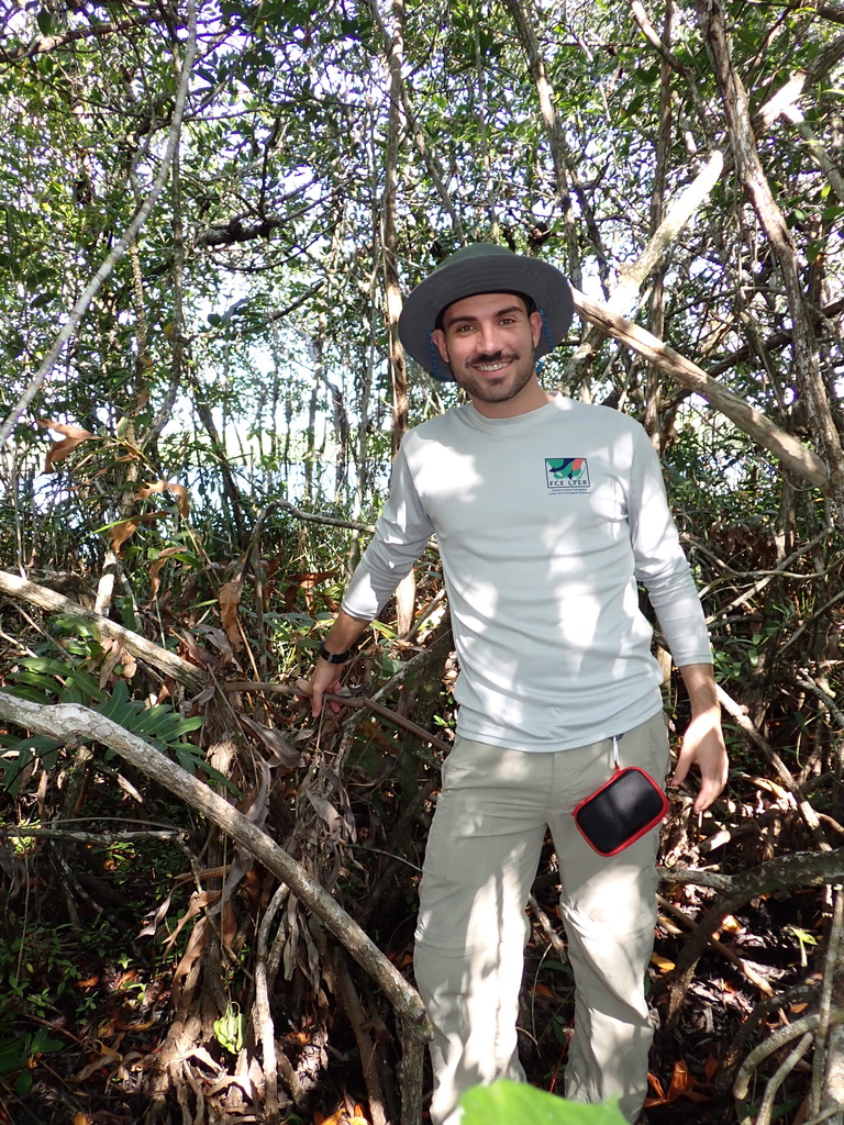
Finally we finish our sampling and return to the boat. Rafa welcomes us back. He is covered head to toe in thick clothes, as though ready for a day of skiing instead of the ninety-five degree muggy heat the day is becoming. He is wearing, in addition to a long sleeve button-down and cargo pants, a full balaclava face mask, sunglasses, fingerless leather gloves, and work boots. Rafa reminds me that while I am out here for one day, this has been his job for 21 years. He has gotten used to the heat, but the beating sun is relentless, and skin cancer is a very real threat for field researchers.
Credit: Tommy Shannon, CC BY-SA 4.0.
Getting Deeper
Credit: Tommy Shannon, CC BY-SA 4.0.
We take the boat to our next monitoring site, heading back downstream to the ocean. As we travel towards the coast, the ground level creeps closer to the sea level. When we arrive at the next site, it becomes apparent that the difference of inches in elevation means a dramatic difference for the ecosystem.
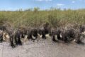
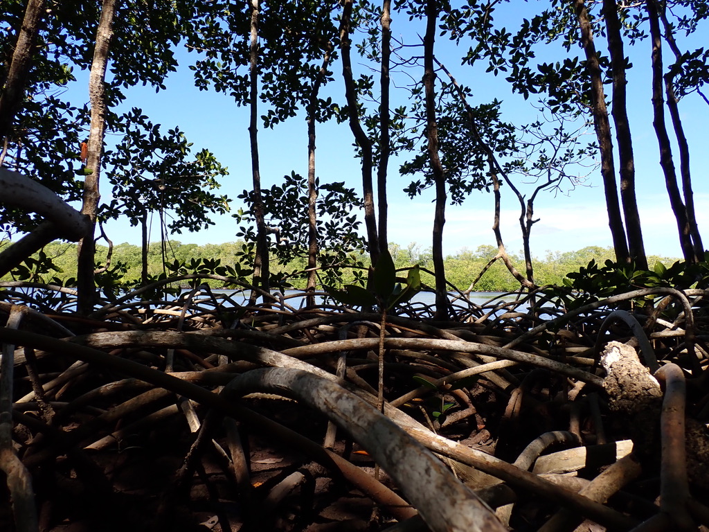
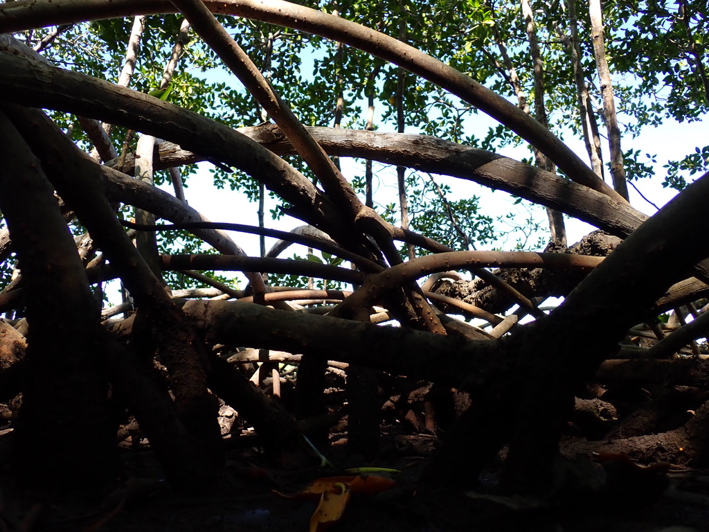
An aerial blanket of bounding mangrove roots covers the ground so thickly that at times it is much easier to walk directly from root to root, feet never touching the ground. Sometimes the dirt disappears altogether beneath us, and we’re left peering at a treacherous floor of tangled roots. We delicately pick our way forward like the cobweb spiders, moving from strand to strand. Where our feet do touch the ground, it is soft springy mud, occasionally squelchy and deep. Clearly this is a place that is periodically underwater: unlike the last site there are few small trees and little leaf debris, just roots and open mud. The canopy cover is still shady, but at eye level there are few branches and leaves, just skinny trunks floating in the air, held up by dozens of arching roots that meet the ground.
Credit: Tommy Shannon, CC BY-SA 4.0.
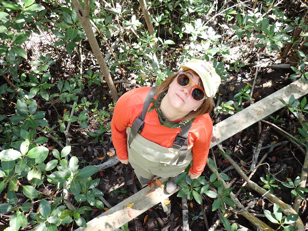
We collect our bounty of leaves and boat on to the final monitoring site. This place is nearly at the coast, and its landscape is more flooded than the others. Some of the forest floor is shallow water; other areas are more elevated and deceptively dry-looking, with little mangrove shoots abound. It is so difficult to walk here that researchers have built a single-plank boardwalk to get around.
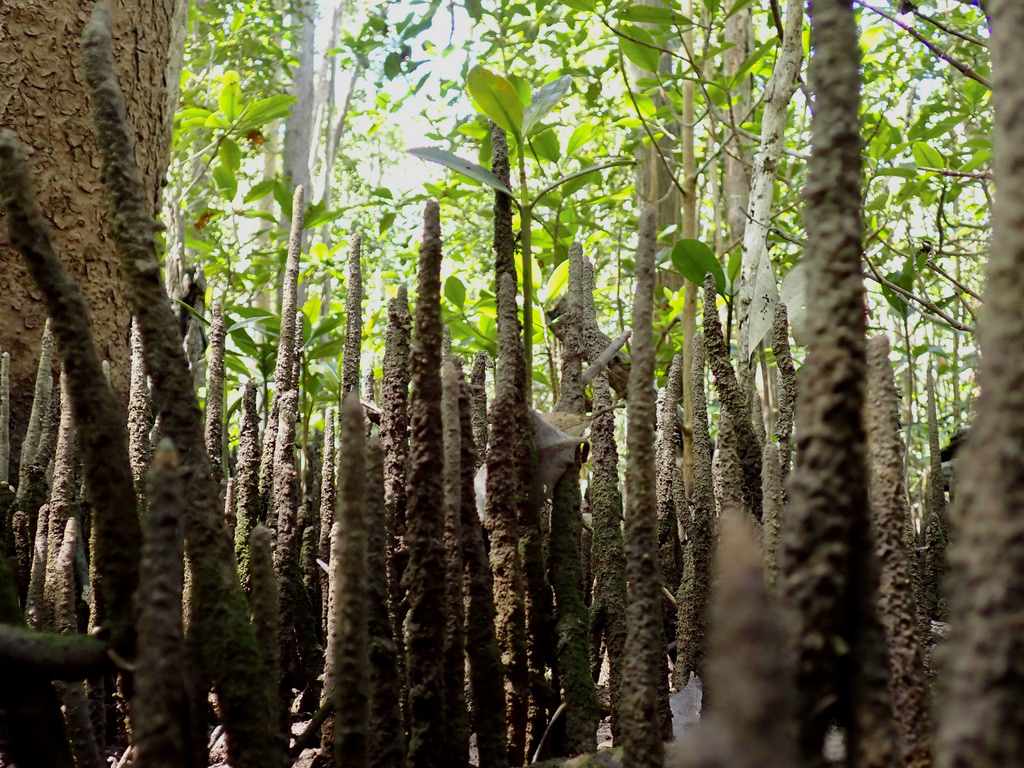
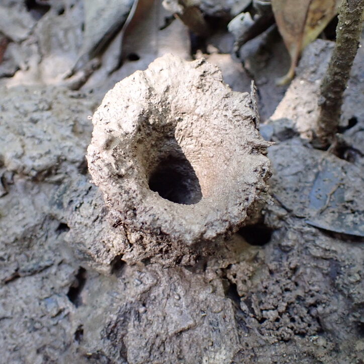
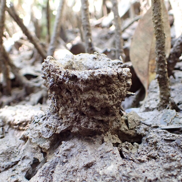
This is a place of storm impact and tidal disturbance, and thus is a place of adaptation and resilience. Red mangroves hang roots down from the canopy, swinging from 20 ft up. When they reach the ground they’ll provide excellent stability for the trees during hurricanes. Black mangroves have a root adaptation that grows in the complete opposite direction: poking up through the mud are thousands of new roots, aimed straight at the sky. These thin shoots act as “snorkels”, enabling the tree roots to access oxygen needed for nutrient exchange. Even the crabs here have adapted, building 3-4 inch tall “chimneys” of mud above their burrows to keep the tide out. By studying the resilience capacity of these environments as sea levels continue to rise, FCE-LTER scientists can develop predictions about the endurance or fate of this ecosystem and others around the globe facing similar climate change threats.
Credit: Tommy Shannon, CC BY-SA 4.0.
Credit: Tommy Shannon, CC BY-SA 4.0.
Credit: Tommy Shannon, CC BY-SA 4.0.
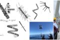
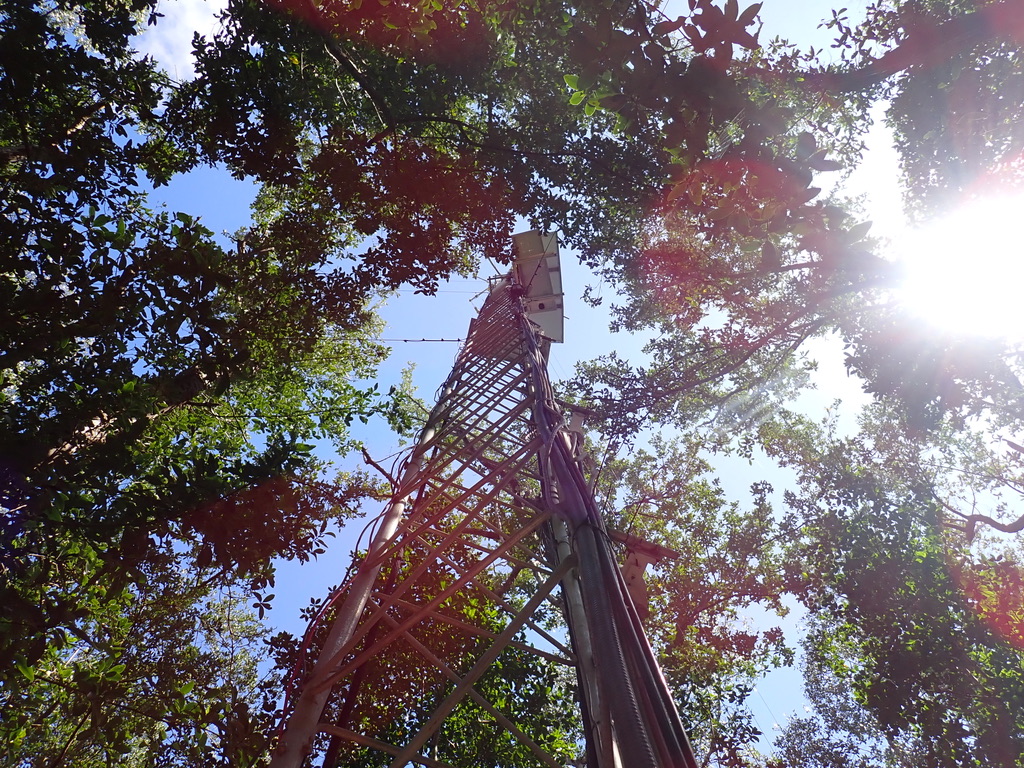
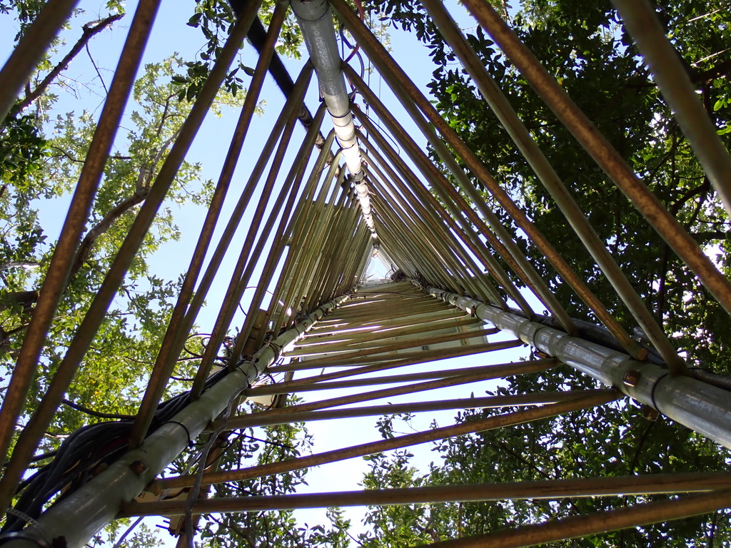
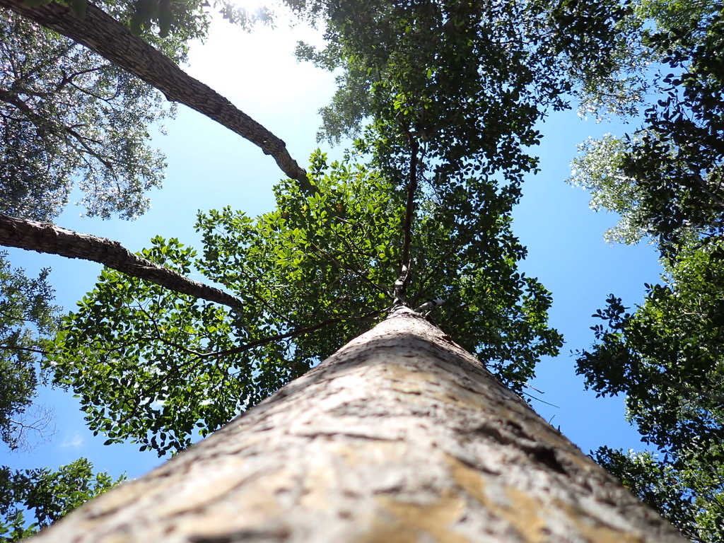
When Paige and I have finished collecting leaves, we return to the boardwalk. We walk the planks deeper into the forest, until we come to the Eddy flux tower. It looks like a big triangular ladder climbing up past the tops of the trees and into the sky. At its top, 85 feet up, are instruments that measure changes in carbon dioxide, water vapor, 3D wind speed, temperature, the sun’s rays, and much more. Solar panels charge the batteries at its base. Data is downloaded to our field laptop every month. This tower provides detailed information on how the mangrove trees are consuming and creating carbon dioxide, which helps FCE-LTER scientists understand how much mangroves may help absorb global carbon emissions. This high-frequency monitoring data connects to our boots-in-the-mud data that spans a greater spatial extent; together, these datasets create a more complete picture of carbon and nutrient cycling over time and space in this dynamic environment.
Credit: Tommy Shannon, CC BY-SA 4.0.
Credit: Tommy Shannon, CC BY-SA 4.0.
The fieldwork is done, but the day is far from finished. We pack our samples into the boat, then begin the long ride towards the marina. It’s a hot day, so the wind on the boat is a welcome friend. The motor drones to the beat of the waves. Despite the long day, I feel energized by the experience. The mangroves are a wonderfully strange place, full of strangely beautiful creatures. I am grateful to have met them.
Credit: Tommy Shannon, CC BY-SA 4.0.
Credit: Tommy Shannon, CC BY-SA 4.0.
Credit: Tommy Shannon, CC BY-SA 4.0.
Credit: Tommy Shannon, CC BY-SA 4.0.
Credit: Tommy Shannon, CC BY-SA 4.0.
Credit: Tommy Shannon, CC BY-SA 4.0.
Credit: Tommy Shannon, CC BY-SA 4.0.
Credit: Tommy Shannon, CC BY-SA 4.0.