Search Results for:
Integrating LTER Research into Ecosystem Management
A Cross-Site Synthesis of Biotic and Abiotic Agents of Decomposition and SOM Dynamics in LTER Sites
To develop the framework of a synthesis paper to Soil Biology & Biochemistry.To review and critique the Integrated Research Challenges (IRC) proposal draft on the DIRT (Detritus Input and Removal…
Ecological Network Analysis for Cross Site Comparisons: Developing the Network of Users
LTER-based Tropical Coastal Research Across the Caribbean Basin
Defining the Schoolyard LTER Program: Priorities, Infrastructure, and Communications
The Schoolyard LTER (SYLTER) program through an annual supplement made available to LTER sites was initiated over three years ago. The program was further expanded when both the Baltimore and…
Advancing the Sharing and Synthesis of Ecological Data: Guidelines for Data Sharing and Integration
1. Develop general strategy for data collection, processing, and distribution that builds on scientist-data manager partnerships to produce data compilations useful for cross-site, long-term synthesis and modeling activities. 2. Develop…
Integration of Research on Biogeochemical cycles at LTER sites
Disappearing Cryosphere: Socioecological Consequences for Ecosystem services
Drupal Environmental Information Management System workshop: Data applications
Our multi-institutional, multi-site group mission is to enable data integration and information synthesis from the foundations of the ecological community, at the minimal organizational level (site, field station), with scalability…
Top Stories

What is seagrass restoration worth on the blue carbon market?
A plant evolutionary ecologist's ode to yellow-bellied marmots

LTER at ESA, 2025
Morning in the Midnight Sun

Leveraging Generative AI: Applications for the LTER Network
Three new SPARC Synthesis Groups demonstrate the value of long-term data collected across ecosystems
Listening First: How KBS is Expanding the Reach of Conservation Research

Ecology: The Science of Resiliency
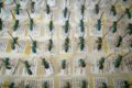
Boxes and boxes of bees—a Sevilleta LTER dataset highlight
Site Exchange Fellows Announced