Sea level rise is eroding Virginia’s barrier islands, potentially flipping carbon rich coastal ecosystems from sinks to sources.
by Nicholas T. Link, PhD Student at Northern Arizona University and Bonanza Creek LTER
Barrier Islands in Retreat
Virginia’s barrier islands are moving. No need to worry though, they’re supposed to. Experts think these islands have been marching landward for about 6,000 years.
Barrier islands, as the name implies, provide shelter for coastal wetlands from crashing ocean waves. The protected wetlands, like salt marshes and unvegetated lagoons, harbor sizable stores of blue carbon – the name for carbon in marine ecosystems – and support many important ecosystem and cultural services. However, with rapid sea level rise, barrier islands are retreating faster than ever, exposing the ecosystems and blue carbon they once defended to the choppy surf. So maybe worry a little bit.
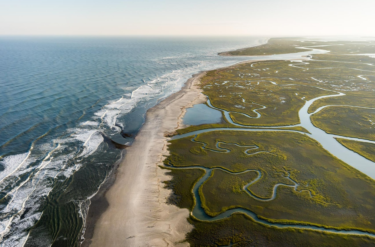
Credit: Credit: Gordon Campbell | At Altitude Gallery., used with permisison.
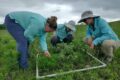
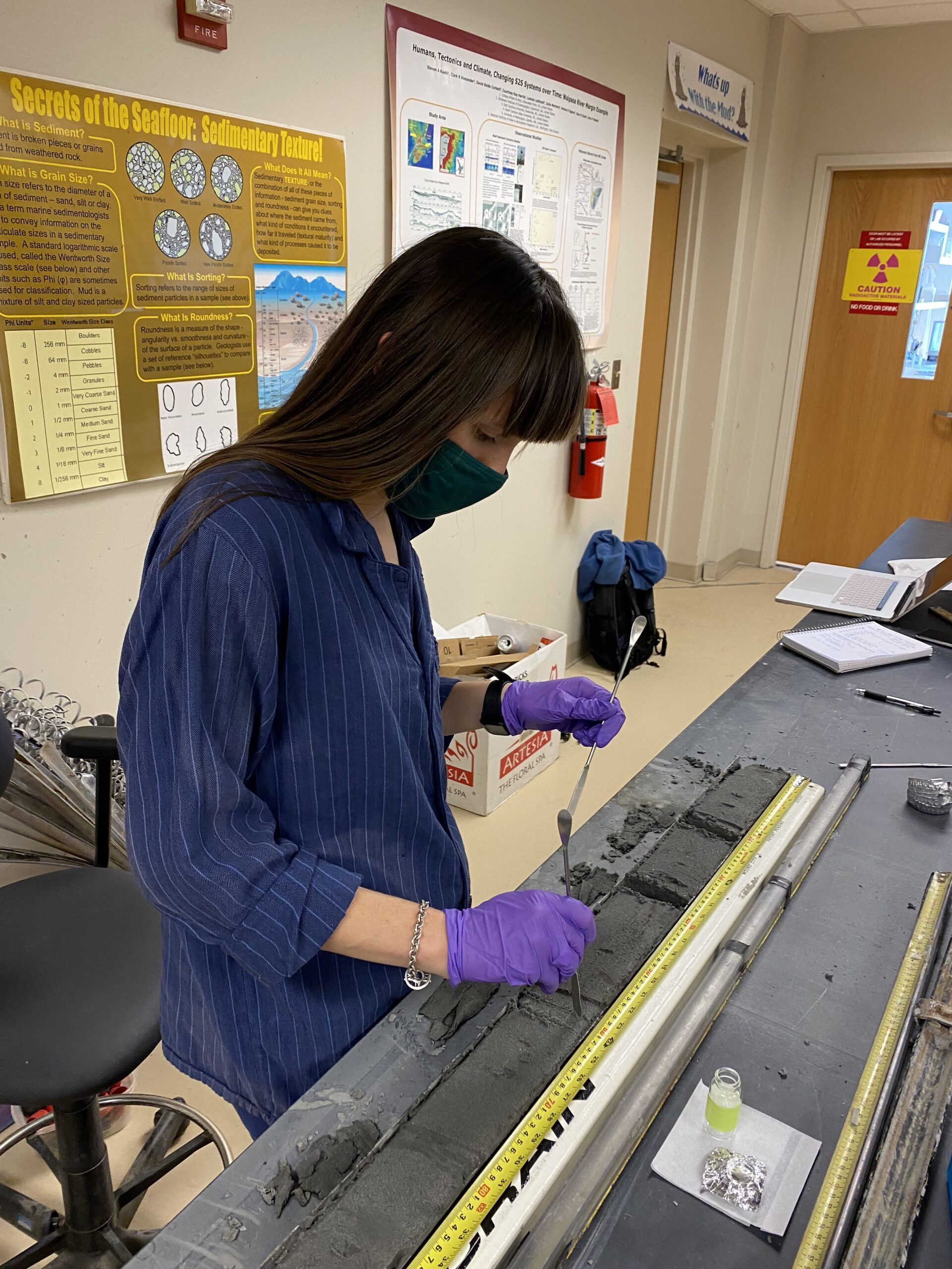
Mary Bryan Barksdale, a PhD student at the Virginia Institute of Marine Science, wanted to understand the impact of migrating barrier islands on blue carbon storage. To do so, Barksdale and co-authors Christopher Hein and Matt Kirwan monitored rates of barrier island movement and carbon flux along Virginia’s barrier islands, which fall within the Virginia Coast Reserve LTER (VCR). Their findings, which were recently published in Nature Communications, show that sea level rise has significantly weakened their functioning as a carbon sink. The work upends our understanding of the stability of carbon storage in these ecosystems.
Those dual discoveries – surprisingly deep erosion of surprisingly carbon-rich sediments – explains why these coastal wetlands now lose more carbon than they gain.
Sinks to Sources
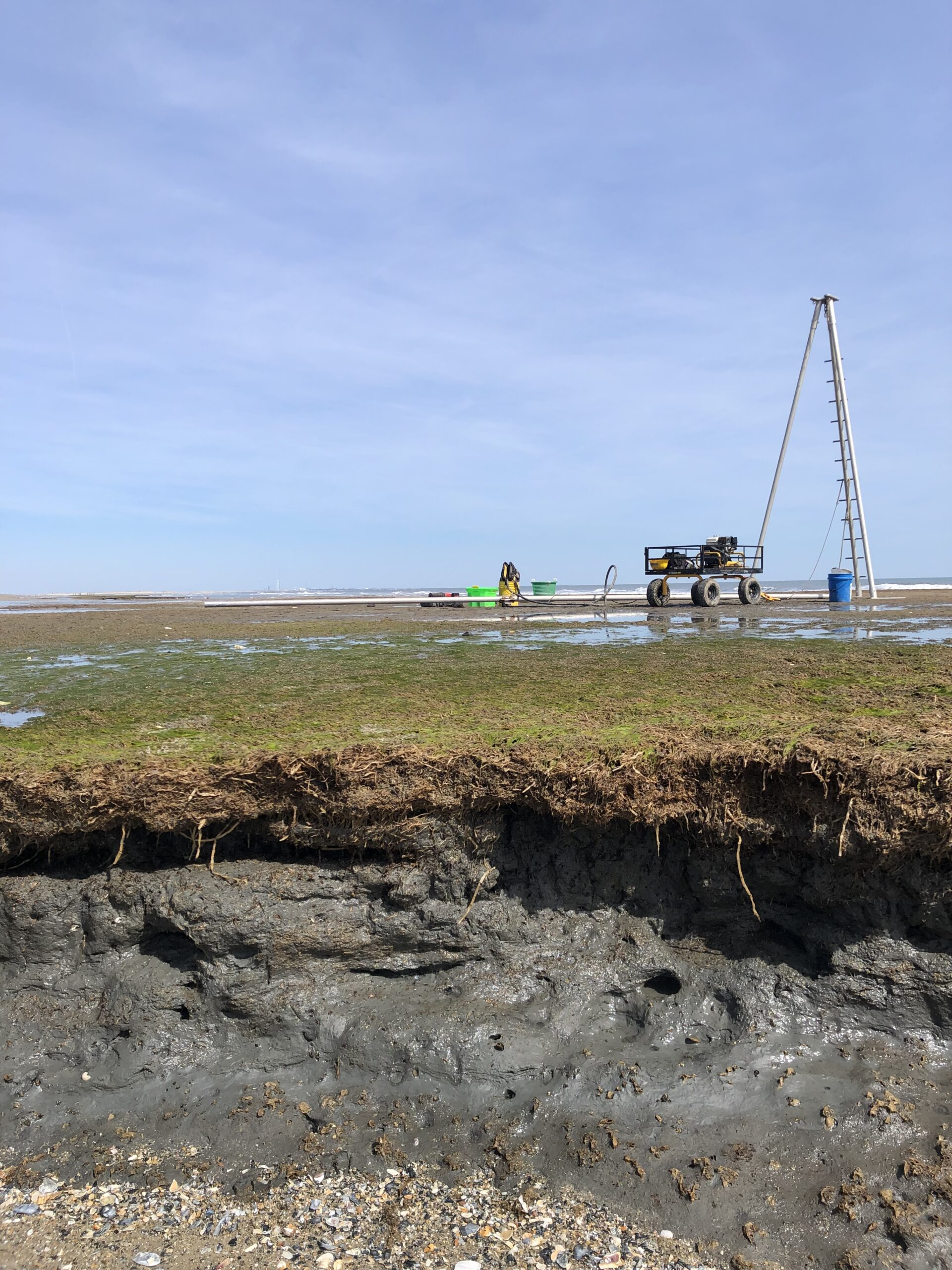
Credit: Mary Bryan Barksdale, CC BY-SA 4.0.
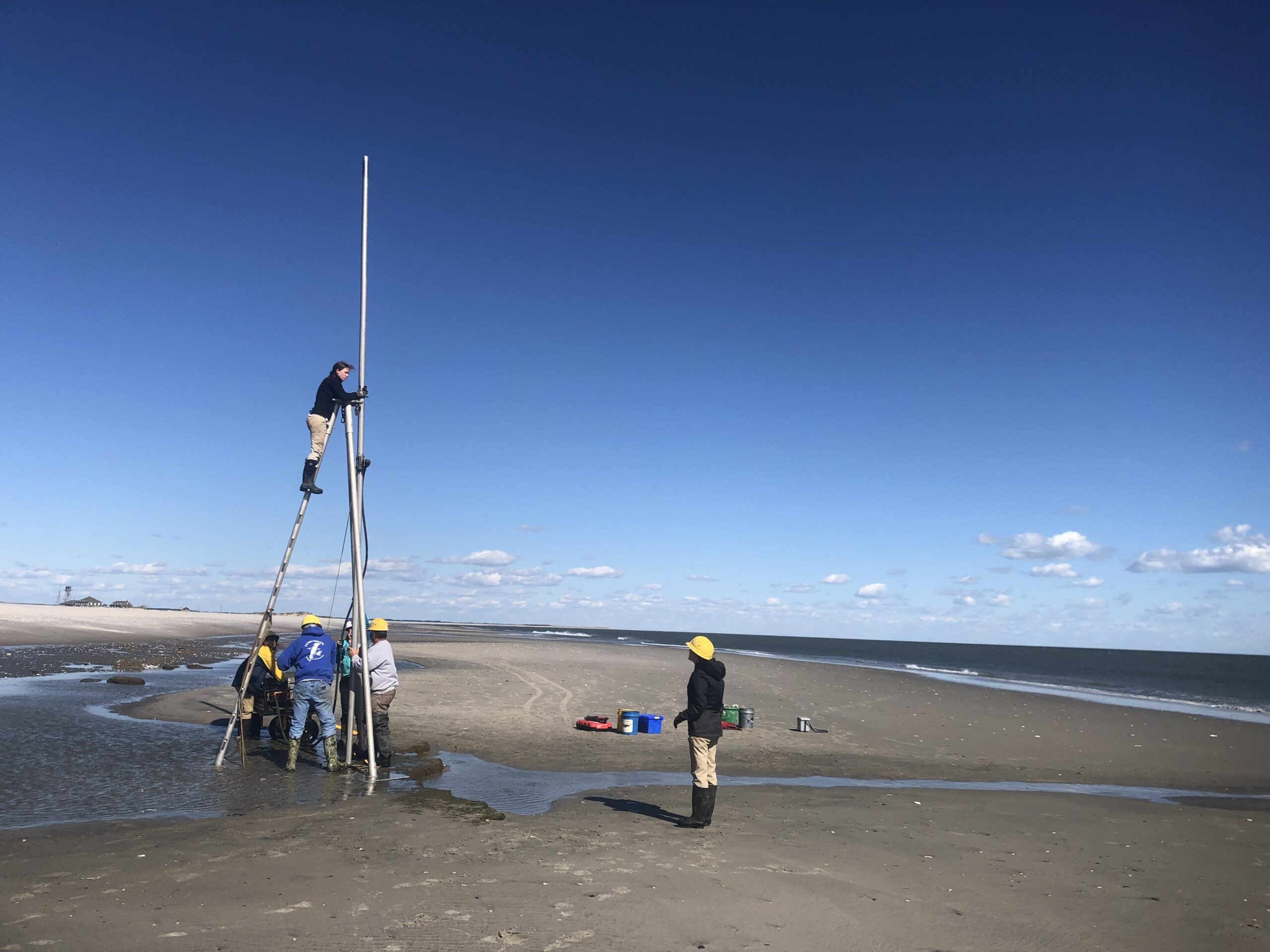
How do you track underground carbon? Or trickier, underground and underwater? By cleverly combining data from deep sediment cores, geochemical analyses, and over 130 years of shoreline location surveys from VCR, Barksdale and her co-authors were able to link changes in carbon storage to barrier island migration.
What they found is troubling. Barrier island systems, which again are famous for sequestering carbon in their often extensive salt marshes and seagrass beds, are actually eroding 26.1 Gg of carbon per year along their shoreface. That’s equivalent to the annual emissions from 22,215 gas powered cars. While the total amount of carbon lost is appalling enough on its own, the fact that these ecosystems are losing carbon at all “implies a new function for the system as a whole,” Barksdale pointed out. “Carbon erosion rates have only begun to outpace carbon accumulation rates in the last several decades as a consequence of rapid sea level rise and resultant upticks in the rate of barrier island migration.”
The Lost, Forgotten Carbon
For a long time, researchers interested in coastal carbon cycling have primarily focused on salt marshes. “It’s visually stunning to look at the amount of salt marsh all up and down the coast,” Barksdale said. “Because of that and their extremely effective biophysical feedbacks that promote sediment trapping and carbon burial, so much attention is given to vegetated coastal systems and their ability to rapidly sequester carbon.” Unvegetated lagoons on the other hand – they don’t get quite as much attention. While these lagoons cover nearly twice the amount of area that salt marshes do, they accrue carbon much more slowly. They are also not quite as visually stunning.
But it’s what’s on the inside that counts. And it turns out that what’s inside unvegetated lagoon sediments is a lot of carbon. These sediments can reach depths of up to seven meters, locking tons of carbon out of the atmosphere.
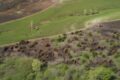
Credit: Mary Bryan Barksdale, CC BY-SA 4.0.
However, as barrier islands migrate landward, those thick sediment deposits lose their protection from turbulent ocean waters and the erosive forces of storm surges. Once completely exposed, that locked away carbon is continually battered by crashing waves and worked away by passing currents. All of that churning causes the unvegetated lagoons to play a greatly outsized role in the ecosystem’s carbon losses. “While the carbon density of lagoon sediments is only one-third that of the salt marsh peat, its ubiquity and thickness across the landscape means that more than 80% of the total carbon erosion is due to erosion of lagoon sediments” Barksdale said. That result caught Barksdale by surprise “given how much it is overlooked as a potential store, and source, of carbon within the traditional blue carbon literature.”
Another underappreciated process uncovered by this research that Barksdale noted: “the depth to which unconsolidated lagoon sediments outcrop along the shoreface of migrating coastlines.” Most previous studies assumed that sediment erosion never occurs deeper than one meter. That assumption may be reasonable on the landward side of barrier islands, but not the seaside, where marsh and lagoon sediments end up as barrier islands retreat. Those dual discoveries – surprisingly deep erosion of surprisingly carbon-rich sediments – explains why these coastal wetlands now lose more carbon than they gain. Barksdale pointed out that those highly productive salt marshes and seagrass beds “are not capturing enough carbon to offset how much is being eroded” in the seaside sediments
The Deep Blue C
So, what should we do? Barksdale highlighted the need to understand carbon dynamics in coastal ecosystems. “If [people are] going to start creating incentives” for conservation such as blue carbon credits, “then we need really accurate carbon budgets.”
To that point, Barksdale wants to understand the long term fate of all that lost blue carbon. “We’re going to answer that in a follow-up study that we’re doing field work for [in 2024],” Barksdale said. Building off their work, other research groups at VCR are planning to use the sediment core data from this study to help calibrate forward looking simulation models. Barksdale explained that those models will “track how carbon erosion rates may change in the future because of accelerating sea level rise and barrier island migration [and] take into account the drop in carbon burial across the landscape as carbon heavy-hitters like salt marshes experience ‘coastal squeeze‘ due to the steady landward march of the islands.”
The value of those simulation models and long term studies is increasingly clear in this and other ecosystems. Studies that can take advantage of rich datasets like Barksdale’s will be crucial to help explain how ecosystem processes are affected by global change factors. As Barksdale excitedly notes, “the Virginia Barrier Islands are a special place”—a sentiment that’s reinforced by their science.
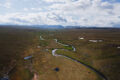
Credit: Mary Bryan Barksdale, CC BY-SA 4.0.