With just a phone camera, anyone can add to a growing dataset tracking environmental change at the Virginia Coast Reserve LTER.
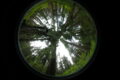
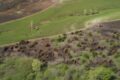
Repeat photography stations are designed to capture change throughout the year. This station, trained on an oyster reef at the Virginia Coast Reserve, is beginning to show the reef growing, along with capturing a huge range of environmental variability through the year.
Credit: Virginia Coast Reserve LTER. CC BY-SA 4.0.
Set, snap, and send
Scattered along the trails that crisscross the Virginia Coast Reserve are wooden posts decorated with an L-shaped bracket on top. A sign adorns the front of each post with an identifying station number and brief instructions: place your phone in the bracket, snap a photo, and send it to a designated email address.
These stations—there are currently five different ones scattered across the reserve—are a new initiative to use community science to generate repeat photography for the LTER. Dozens of people, if not hundreds in the peak of summer, walk the reserve trails every day. If just a few use the stations, mount their phone and take a snap of the ecosystem, before long researchers will have visual documentation of change throughout the year. And with every snap, the photographer thinks about the LTER, the research they do, and closes the gap between the two communities.
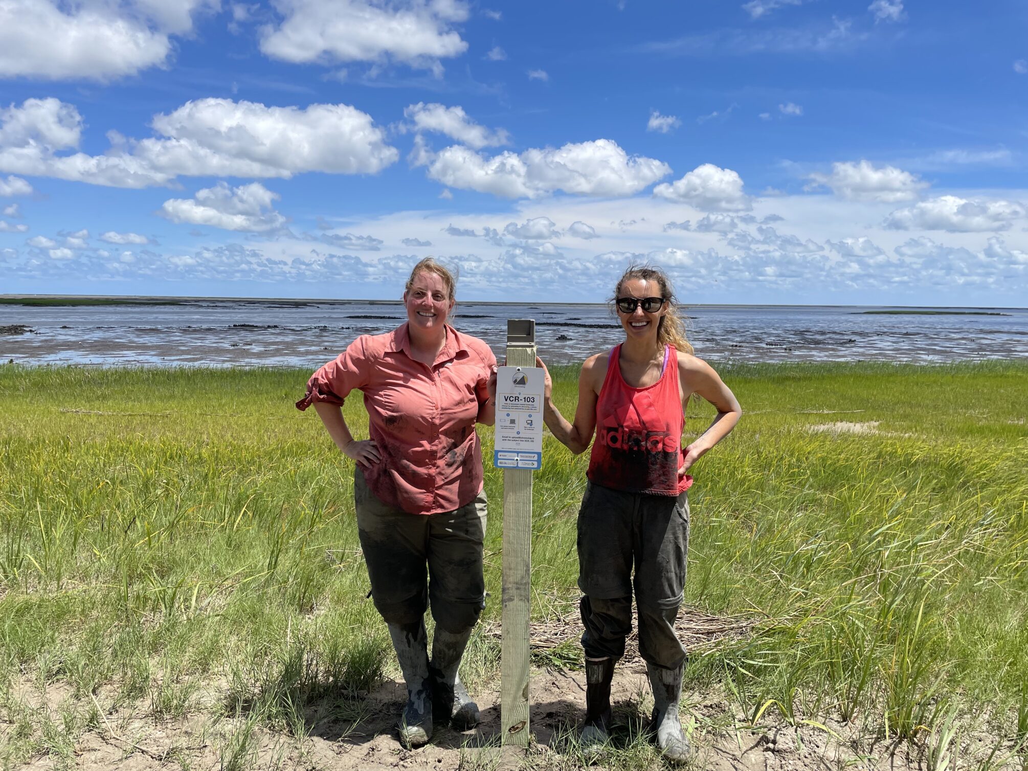
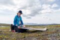
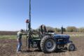
Serina Wittyngham (left) and Kinsey Tedford (right) stand next to their freshly installed Chronolog station at the Virginia Coast Reserve
Credit: Kinsey Tedford, CC BY-SA 4.0.
Change is coming to Virginia’s Eastern Shore
Communities on the Eastern Shore of Virginia hang in precarious balance with nature. Just a small sliver of barrier islands and coastal estuaries separate the small towns from the Atlantic. And the barrier island ecosystems—the community’s backyard—are changing fast. Sea level rise here is between three and four times worse than the global average. The coastal soil is getting saltier. Storms are becoming more frequent, and more intense.
Researchers at the Virginia Coast Reserve LTER study how the coastal barrier island ecosystem is changing. Their research has direct impacts for the Eastern Shore community. But connecting the community to LTER science isn’t always easy. “ Almost everyone that lives out there knows about the LTER,” Serina Wittyngham, a graduate student at the LTER, says. “But sometimes, they don’t know exactly what we do.”
Wittyngham and her fellow graduate student Kinsey Tedford wanted a way for the Virginia Coast Reserve LTER to generate conversations about the LTER’s role in documenting local change with the nearby residents. Community generated repeat photography—the tactic they eventually chose—opens the door to those conversations. Repeat photography allows anyone to participate in the scientific process. It reinforces that change is happening at the Virginia Coast Reserve by asking residents to document it. It reminds participants that the LTER operates in their community. And, it informs residents about the kinds of research questions LTER scientists are asking.
And, notably, repeat photography remains a viable outreach tool even during Covid-19.

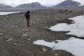
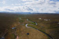
The repeat photography station on the Eastern Shore of the Virginia Coast Reserve captures vegetation changes along the waterfront throughout the year.
Credit: Credit: Virginia Coast Reserve LTER. CC BY-SA 4.0.
Tedford and Wittyngham partnered with Chronolog, a specialist in repeat photography monitoring, to implement the project at the LTER. The actual device, a square bracket on a post, is simple, Tedford says. But for a small fee, Chronolog handles the more complicated tasks, like collecting the photos, creating time lapses, and they even 3D print each mounting bracket.
Users can upload photos via email—no app required. Plus, Chronolog’s web interface means that a community member can instantly view all the other photos taken at that station. So, as the photographer wonders about the changes they might document in the ecosystem, they can see how the series of photos have already captured changes throughout the year.
Tedford and Wittyngham’s outreach extends beyond putting posts in the ground. Tedford is helping teachers develop K-12 science education curriculum based on repeat photography at the Virginia Coast Reserve. The project includes a field trip out to the sites and in-classroom activities. Her goal, she relays, is to develop a way for students to collect data from the photographs that can later be used by the LTER. They’re working on partnering with local organizations, like the Eastern Shore’s Boy Scouts and Master Naturalists, to broaden their outreach.
The data are useful, too!
While Tedford and Wittyngham see repeat photography as primarily an outreach tool, their sites are already generating useful data for LTER science. Tedford and Wittyngham chose their stations wisely, with camera brackets trained on oyster reefs, mudflats, and marshland. The pictures should, in time, reveal changes such as oyster reef migration or plant community shifts.
But, surprisingly, the connections with the community are also providing valuable information for LTER science. “Some of the best people you can talk to are the long-term residents on the shore”, Wittyngham says. At some of her research sites, residents can add key observations from generations back that scientists might miss—such as one gentleman relaying that a dead tree was cut down as a Christmas tree, rather than the result of some disease. By opening a dialogue with the community, repeat photography opens the door to the community’s generational knowledge. The project, less than a year old, has already unearthed knowledge from decades back.
Other LTER’s are joining the movement
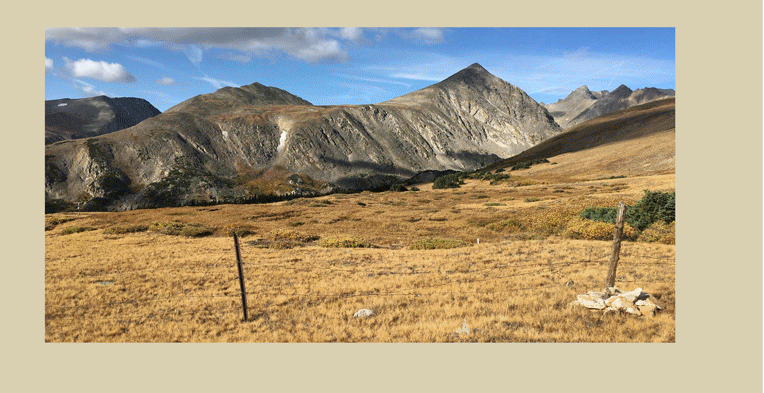
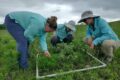
The Chronolog station at the Niwot Ridge LTER captures changes to the alpine tundra. Community members still manage to contribute photos to this remote site.
Credit: Credit: Niwot Ridge LTER. CC BY-SA 4.0
Two other LTER sites joined the Virginia Coast Reserve LTER in implementing community generated repeat photography projects this year. The Niwot Ridge LTER, with sprawling alpine ecosystems and close proximity to Colorado’s Front Range, has two stations up and running. The Cedar Creek LTER has three camera stations trained on completely different ecosystems: a bog, a lake, and an oak savannah.
Tedford and Wittyngham hope the repeat photography stations spread to many other LTER sites, especially those with a local community. The pair already completed much of the legwork in setting up the Virginia Coast Reserve’s stations, including partnering with Chronolog and getting a discount towards the cost of establishing new sites. All new sites need is a motivated individual to spearhead the project and install the posts.
The future is bright for repeat photography
The three LTER’s are the first to implement community generated repeat photography. The projects are already proving successful. They generate consistent community engagement, and have already provided valuable data. But Tedford and Wittyngham are already looking towards the future.
The longer these projects go on, and the more sites that implement repeat photography stations, the greater the potential impact for LTER science. The datasets, visual documentation of change across the network, provide incredible opportunities for generating new research and potentially cross-site synthesis. Getting local communities involved in LTER science means research and outreach around the network have a bigger impact. And, hey, everyone is sure to appreciate a stunning timelapse.
For more information on community generated repeat photography, Chronolog, or setting up a station at your LTER site, reach out to Kinsey Tedford or Serina Wittyngham.
By Gabriel De La Rosa