Find out what makes an urban LTER site with examples from three ecosystems at the Central Arizona-Phoenix Long-Term Ecological Research site.

Credit: Gabriel De La Rosa, CC BY-SA 4.0
Tres Rios Wetland
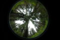
On the southwestern edge of Phoenix, just past one of the city’s largest slaughterhouses, just shy of the dry riverbed of the Salt River, is an oasis in the desert. Teeming with life, the 42-hectare Tres Rios Wetland hosts over 150 bird species and has reeds so thick you might mistake them for a corn field.
Yet this gorgeous wetland is a completely manufactured environment. The Tres Rios wetland was built to function as the last treatment step for Phoenix’s largest wastewater treatment facility. It was dug out of the desert, flooded, and planted with wetland flora just over a decade ago.
Tres Rios perfectly encapsulates the urban-ecological paradigm, where landscapes are a result of both humans and nature. The Central Arizona-Phoenix LTER site, founded in 1997, conducts long-term ecological research among the patchwork of urban-ecological spaces scattered around Phoenix.
When a wetland suddenly appears in the desert, for example, the LTER seeks to understand how the surrounding ecology changes. Here, the changes were stark. Researchers counted over 150 unique species of birds at the wetland. The citizen science total is north of 250 species. Some are unexpected, including a flock of pelicans. Others stop through briefly on migratory routes. Very few resided in the area before Tres Rios.
But possibly the wildest phenomena revealed through research at the wetland is the discovery of the “biological tide.” During the day, thick wetland vegetation draws so much water for transpiration that surface water in the ground nearby is sucked into the wetland. CAP researchers discovered the tide after noticing their calculated water and nitrogen budgets for the marsh left a portion of their flux unaccounted for.
South Mountain
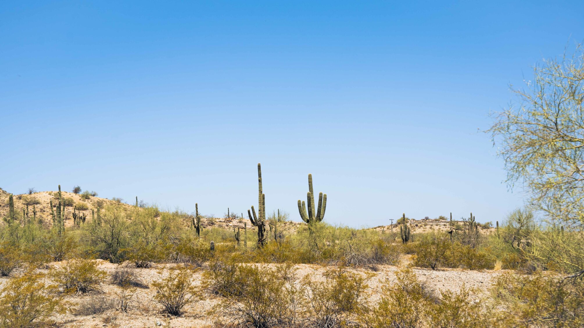
Credit: Gabriel De La Rosa, CC BY-SA 4.0
Over the hill from Tres Rios lies South Mountain. South Mountain is a nature preserve, relatively free from human impact. Saguaro arms pierce the skyline, and through a gap in the hills downtown Phoenix looks miles away.
Yet even here, human influence drifts in on the wind.
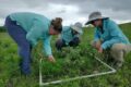
Nitrogen dust floats in from the city, settling on the desert and enriching the soil. Researchers at CAP study the effects of nitrogen deposition through observation, but also through experiments.
The DesFert experiment adds nitrogen and phosphorus to experimental desert plots at South Mountain. Researchers look for changes in the plant community and soil biogeochemistry, among other measures, after adding nutrients.
The farther from the city, the less nutrient deposition landscapes receive. The DesFert experiment allows researchers to simulate the enrichment gradient by applying different amounts of nutrients to different plots. These results help understand how the city impacts natural open spaces, such as South Mountain.
Indian Bend Wash
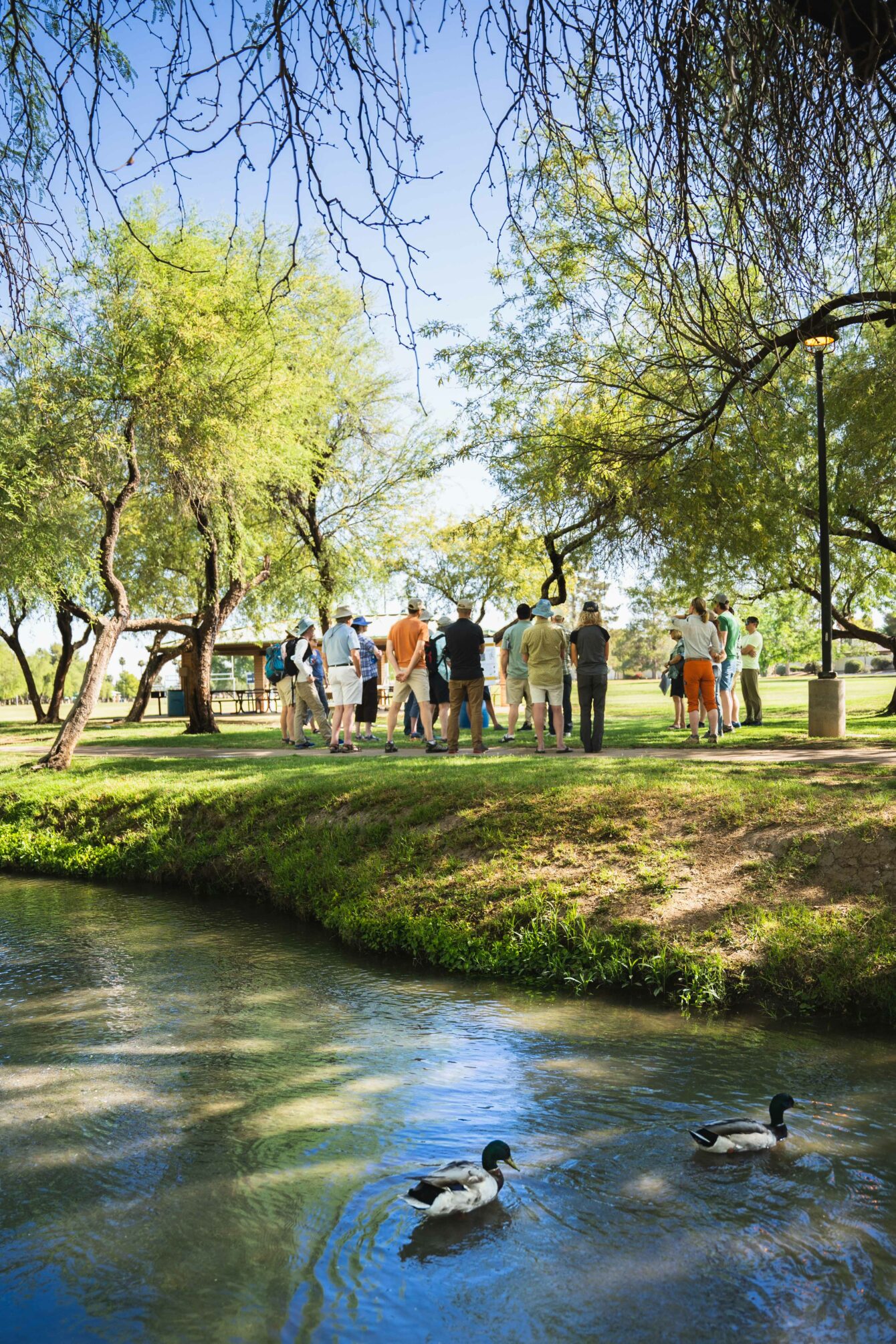
Credit: Gabriel De La Rosa, CC BY-SA 4.0
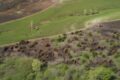
Manicured green grass fields, duck ponds, picnic tables and public restrooms. Indian Bend Wash is a quintessential public park, sandwiched between developed suburban neighborhoods.
The park extends for miles, following a natural drainage, and remains a picturesque suburban facade its entire way.
Yet the wash holds a secret. The park was designed to remediate flash floods in the heart of the city. Indeed, the edge to edge turf dips in the center, forming a shallow concave drainage for its entire length.
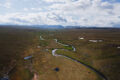
Researchers at the CAP LTER study how urban drainages like the Indian Bend Wash affect nutrient and hydrologic flows within the city. Using a string of automated water samplers, several sites stream back data each time a storm passes through the city. Together, the project reveals how differing infrastructure changes the ecology of urban watersheds.
Green spaces like the Indian Bend Wash form the backbone of Phoenix’s “Urban Ecological Infrastructure.” The term refers to any urban place with some ecological benefit—in this case stormwater mitigation. The term encompasses a broad range of infrastructure, including lawns, urban water features, mid-city agricultural plots, abandoned land, and the Tres Rios Wetland, for starters.
Phoenix residents interact with all these places, in some cases creating them (lawns), in others benefitting from them (Indian Bend Wash). The CAP LTER studies human-environment interactions through their Phoenix Area Social Survey. The survey reveals how Phonecians perceive Urban Ecological Infrastructure, the surrounding desert, local flora and fauna, and so forth. Read an in-depth story on the Phoenix Area Social Survey here.
A special thank you to Dan Childers for hosting the 2022 LTER Science Council Meeting in Phoenix, to CAP researchers Quincy Stewart and Becky Ball for showing us around South Mountain, Kelli Larson and Stevan Earl for explaining the Phoenix Area Social Survey at the Indian Bend Wash, to Julia Hernandez and Luke Ramsey for their tour of the Tres Rios Wetland, and to everyone else that made the meeting a success.
By Gabriel De La Rosa