Site Contacts
Site Details
- to document long-term patterns of environmental forcing to the coastal zone,
- to link environmental forcing to observed spatial and temporal patterns of biogeochemical processes, primary production, community dynamics, decomposition and disturbance,
- to investigate the underlying mechanisms by which environmental gradients along the longitudinal (freshwater-saltwater) and
- lateral (upland-subtidal) axes of estuaries drive ecosystem change, and
- to explore the relative importance of larval transport and the conditions of the adult environment in determining community and genetic structure across both the longitudinal and vertical gradients of the estuary.
In GCE-I, we began to describe the patterns of variability in estuarine processes with an emphasis on water inflow as a primary environmental forcing function. During GCE-II, we will continue our focus on patterns of variability, but we will also work to elucidate the mechanisms that underlie this variation and in particular the extent to which gradients in water inflow drive landscape patterns. In so doing, we recognize the necessity of evaluating the interaction of inflow-driven changes with other factors that influence estuarine processes (i.e. geologic setting, organismal interactions, etc.). The central paradigm of GCE-II is that variability in estuarine ecosystem processes is primarily mediated by the mixture of fresh and salt water flow across the coastal landscape.
The GCE-II project will address five key questions:
Question 1: What are the long-term patterns of environmental forcing to the coastal zone?
Approach: During GCE-II we will continue to
- monitor patterns of environmental forcing and the propagation of freshwater to the coastal zone
- obtain relevant long-term datasets from other organizations
- synthesize these data to identify long-term trends driving coastal ecosystems.
In particular, the UGA Marine Extension Service is compiling all available historic water quality observations for the Georgia coast into a single GIS. When the project is complete, we will take advantage of this information and work with Marine Extension to integrate it with the GCE-LTER database.
Question 2: How do the spatial and temporal patterns of biogeochemical processes, primary production, community dynamics, decomposition, and disturbance vary across the estuarine landscape, and how do they relate to environmental gradients?
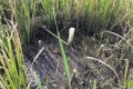
Approach: GCE monitoring sites are distributed along an onshore-offshore gradient across three sounds and experience different patterns of environmental forcing. To document environmental gradients across the GCE landscape, we monitor water column salinity, temperature, and pressure every 30 min, and measure nutrient chemistry, and chlorophyll concentrations monthly. During GCE-II we will deploy temperature, salinity and pressure loggers adjacent to sediment elevation tables to record short term variability on the marsh platform at each site. These instruments will allow us to rigorously link tidal fluctuations in the water column to patterns of marsh inundation and salinity variation in the pore water. We will also measure upland and marsh groundwater levels and chemistry monthly at permanent wells installed at sites 3, 4 and 10 and will install wells at additional marsh hammock sites during GCE-II. To document ecosystem responses to environ-mental gradients, we monitor soil accumulation, compaction and decomposition, and plant and animal biomass, densities, and community composition.
Question 3: What are the underlying mechanisms by which the freshwater-saltwater gradient drives ecosystem change along the longitudinal axis of an estuary?
Approach: The centerpiece of this work will be an integrated effort to quantify the interplay between geochemical factors, microbial activity, soil preservation, and populations of plants and animals in marsh sediments. Our objectives are:
- to document existing down-estuary patterns of salinity and sulfate, sediment biogeochemical parameters, soil characteristics, and plant and animal populations
- to experimentally assess the responses of sediment biogeochemistry, microbial activity, soil characteristics, decomposition rates, and plant and animal populations to increased salt and sulfate availability
- to integrate the results in a quantitative framework using mathematical models.
Question 4: What are the underlying mechanisms by which proximity of marshes to upland habitat drives ecosystem change along lateral gradients in the intertidal zone?
Approach: The large number and diversity of hammocks (i.e. in terms of size, development, and origin) within the GCE domain provide a natural laboratory for evaluating the influence of landscape structure and freshwater input on marsh processes. We will conduct a combination of observational, modeling, and experimental studies geared towards describing how (and whether) differences in the characteristics of upland environments can affect the adjacent marsh. Our goal is to be to able to add information on upland-marsh linkages to our initial description of broad spatial gradients in freshwater inflow across the GCE domain.
Question 5: What is the relative importance of larval transport versus the conditions of the adult environment in determining community and genetic structure across both the longitudinal and lateral gradients of the estuarine landscape?
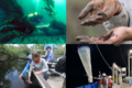
Approach: We will address these questions using a suite of methods that have been refined in rocky intertidal and coral reef systems. In particular, we will document distribution patterns, measure recruitment using larval traps, outplant species with and without competition to measure post-recruitment survival and growth, use molecular tools to identify patterns of genetic structure across sites, and use cellular automata models to explore how various mechanisms might create population structure across the landscape. We will use a comparative approach, working with a range of species chosen for ecological importance, experimental tractability, and contrasting life histories.
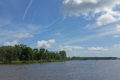
Read LessPatterns and processes in this complex landscape vary spatially within and between sites, and temporally on multiple scales (tidal, diurnal, seasonal, and inter-annual). Overlain on this spatial and temporal variation are long-term trends caused by climate change, sea level rise, and human alterations of the landscape. These long-term trends are likely to manifest in many ways, including changes in water quality, river discharge, runoff and tidal inundation patterns throughout the estuarine landscape.
Over the coming decades, the Georgia coast (like all coastal areas) is expected to experience substantial changes due to factors such as climate change, sea level rise, and human alterations of the landscape. In addition, the landscape likely bears legacies of several thousand years of human occupation, although these have been poorly documented. These effects are likely to be manifest in many ways, including major changes in runoff and inundation patterns throughout the estuarine landscape.
The overarching goal of the GCE LTER is to understand the mechanisms by which variation in the quality, source and amount of both fresh and salt water create temporal and spatial variability in estuarine habitats and processes, in order to predict directional changes that will occur in response to long-term shifts in estuarine salinity patterns.
Read LessThe Georgia Coastal Ecosystems LTER is building on the long term legacy of scientific study and ecosystem preservation that have been established by the University of Georgia Marine Institute (UGAMI) on Sapelo Island since 1954 and the Sapelo Island National Estuarine Research Reserve (SINERR) established in 1976. Additionally, the Georgia Rivers LMER (GARLMER), which was concluded in October 2000, examined processing of materials transported through the intertidal zone of the Altamaha River and of 4 other Georgia coastal rivers.
Since the Georgia Coastal Ecosystems LTER site was initially funded in May 2000, we have established a comprehensive environmental monitoring network to map spatial and temporal variability and mean values of key environmental factors throughout the GCE study area. This network is composed of independent monitoring stations operated by the GCE program and stations operated in collaboration with other programs and agencies (UGA Marine Institute, SINERR program, and USGS).
Core data from the monitoring program is distributed to the LTER and broader scientific community through a web-accessible catalog and KNB project data repository. Data from additional monitoring resources is also regularly acquired and used to extend the temporal and spatial scale of GCE observations, including the National Data Buoy Center's Gray's Reef buoy, Georgia Rivers LMER data, and National Weather Service records for Sapelo Island.
A Schoolyard LTER program (S.A.P.E.L.O. - Scientists and Professional Educators Learning Outdoors) was also established in 2001. An initial workshop hosted 10 teachers representing all areas of the state, and since then the program has grown and now operates two sessions each summer. To date, 55 teachers have participated in the program and those teachers have now served over 5300 K-12 students across Georgia.
Read Less